Cof Cymru: National Historic Assets of Wales · Wales
Craffryn
Llanfihangel Rhydithon, Powys, Wales
A Grade II listed building in Craffryn, Llanfihangel Rhydithon, Powys, designated on 17 June 1993.
The record
- Designation
- Listed building, Grade II
- Broad class
- Domestic
- Date of designation
- 17 June 1993
- Locality
- Craffryn
- Community
- Llanfihangel Rhydithon
- Unitary authority
- Powys
- Country
- Wales
- Coordinates
- 52.28932, -3.25087
- Cadw reference
- 9279
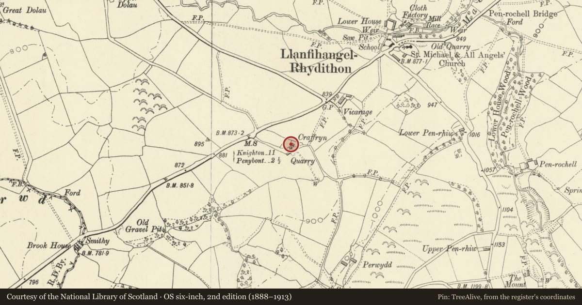
Slide toward Today to fade the historical sheet and see the modern map underneath.
David Rumsey Map Collection, Stanford LibrariesDavid Rumsey Map Collection, Stanford LibrariesDavid Rumsey Map Collection, Stanford LibrariesDavid Rumsey Map Collection, Stanford LibrariesDavid Rumsey Map Collection, Stanford Libraries
5 historical maps cover this location, the earliest the 1608 map "(13) Cambriae Typus." (David Rumsey Map Collection, Stanford Libraries).
Historical maps covering this location
- 1608 · (13) Cambriae Typus. (David Rumsey Map Collection, Stanford Libraries)
- 1637 · Particular description of Wales. Cambria seu Wallia (David Rumsey Map Collection, Stanford Libraries)
- 1883 · Watershed map England, Wales 3. (David Rumsey Map Collection, Stanford Libraries)
- 1899 · 180 Knighton (Hills) (David Rumsey Map Collection, Stanford Libraries)
- 1901 · Sheet 14. (David Rumsey Map Collection, Stanford Libraries)
Cadw's description
Location
Lies 500m south-west of Llanfihangel Rhydithon, 100m south of A488 on north side of by-road.
Exterior
1849 (datestone now in garden, removed when west end stack added). Replaces earlier dwelling now used as farm store. Two storeys, coursed rubble blocks, low plinth, boxed eaves, deep verges, slate roof. Two brick end stacks. Steps lead up to central door, boarded and battened in heavy chamfered frame. Three-window range all openings under stone voussoir heads with key blocks. Original multi-pane lights with chamfered frames and iron opening casements. Brick porch to rear.
Interior
Plan of front kitchen, central stairs and small parlour, rear dairy and scullery. Large open rubble-stone fireplace with scroll-stopped timber lintel and brick bread-oven in kitchen.
Reason for designation
A good example of a mid C19 farmhouse retaining its character. Interesting group value with outbuildings (including original farmhouse) adjoining.
Nearby in the register
- Outbuilding immediately to SW of CraffrynDomesticunder 1 mi
- Barn/Cowhouse Range to CraffrynAgriculture and Subsistenceunder 1 mi
- Milestone in grass verge close to junction with lane to CraffrynTransportunder 1 mi
- The Parish HallRecreationalunder 1 mi
Other entries of the same register within about three miles of this one, by straight line.