Cof Cymru: National Historic Assets of Wales · Wales
Part of L-Plan Range at Lower House Farm
Llanfihangel Rhydithon, Powys, Wales
A Grade II listed building in Llanfihangel Rhydithon, Powys, designated on 17 June 1993.
The record
- Designation
- Listed building, Grade II
- Broad class
- Agriculture and Subsistence
- Date of designation
- 17 June 1993
- Community
- Llanfihangel Rhydithon
- Unitary authority
- Powys
- Country
- Wales
- Coordinates
- 52.29268, -3.24643
- Cadw reference
- 9275
Slide toward Today to fade the historical sheet and see the modern map underneath.
David Rumsey Map Collection, Stanford LibrariesDavid Rumsey Map Collection, Stanford LibrariesDavid Rumsey Map Collection, Stanford LibrariesDavid Rumsey Map Collection, Stanford LibrariesDavid Rumsey Map Collection, Stanford Libraries
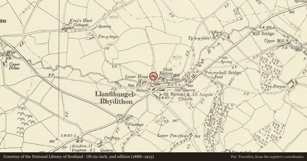
5 historical maps cover this location, the earliest the 1608 map "(13) Cambriae Typus." (David Rumsey Map Collection, Stanford Libraries).
Historical maps covering this location
- 1608 · (13) Cambriae Typus. (David Rumsey Map Collection, Stanford Libraries)
- 1637 · Particular description of Wales. Cambria seu Wallia (David Rumsey Map Collection, Stanford Libraries)
- 1883 · Watershed map England, Wales 3. (David Rumsey Map Collection, Stanford Libraries)
- 1899 · 180 Knighton (Hills) (David Rumsey Map Collection, Stanford Libraries)
- 1901 · Sheet 14. (David Rumsey Map Collection, Stanford Libraries)
Cadw's description
Location
Situated downhill in the centre of Llanfihangel Rhydithon, 100m north-west of the main road and parish church. Courtyard range of farmhouse and outbuildings, unoccupied and used as farm store for many years.
Exterior
C15 two-unit, cruck-framed former house with two further bays at south-east end of C17/18 date. Refronting and back-kitchen wing at north-west end C19. Rubble stone in regular coursed blocks with plinth, boxed eaves, slate roof, rubble end stack to left, brick stack to rear right. Steps up to central door under cambered voussoir lintel, boarded door in heavy frame. Regular arrangement of windows with voussoir lintels and brick cills, mainly boarded up. The first-floor windows very narrow and set under the eaves. The left-hand end bay has weatherboarded upper floor and large double doors below.
Barn/Cowhouse range adjoining at right angles to former house: Only partial inspection of barn end possible. Appears to be C17 in origin but with some replacement trusses and wall-framing of C18 and C19 date. External elevations mainly weatherboarded under slate roof, ground-floor of cowhouse in rubble stone. Boarded doors and loft shutters.
Interior
Substantial survival of original cruck trusses and partition walls. The latter of large horizontal timber-frame panels with wattle and woven lath infil. Left-hand room has large blocked fireplace with ovolo moulded lintel, axial beam with deep chamfer and step stop, exposed joists.
Central room has chamfered axial beam, exposed joists and large salting slab on brick piers. Right-hand room has chamfered axial beam with scroll stops, small brick-lined C19 corner fireplace. Flag-floors. Later roof raised above cruck trusses.
Reason for designation
Good surviving vernacular farm grouping with signficant late medieval fabric to house.
Nearby in the register
- Part of L-Plan range at Lower House FarmAgriculture and Subsistenceunder 1 mi
- The Parish HallRecreationalunder 1 mi
- CraffrynDomesticunder 1 mi
- Outbuilding immediately to SW of CraffrynDomesticunder 1 mi
Other entries of the same register within about three miles of this one, by straight line.