Cof Cymru: National Historic Assets of Wales · Wales
Former Granary to stable-yard at Harpton Court
Old Radnor, Powys, Wales
A Grade II listed building in Harpton, Old Radnor, Powys, designated on 15 February 1993.
The record
- Designation
- Listed building, Grade II
- Broad class
- Domestic
- Date of designation
- 15 February 1993
- Locality
- Harpton
- Community
- Old Radnor
- Unitary authority
- Powys
- Country
- Wales
- Coordinates
- 52.23148, -3.12200
- Cadw reference
- 9178
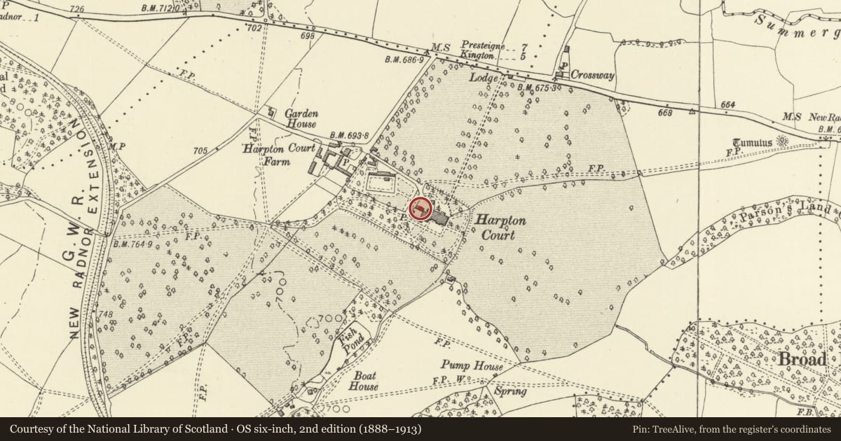
Slide toward Today to fade the historical sheet and see the modern map underneath.
David Rumsey Map Collection, Stanford LibrariesDavid Rumsey Map Collection, Stanford LibrariesDavid Rumsey Map Collection, Stanford LibrariesDavid Rumsey Map Collection, Stanford LibrariesDavid Rumsey Map Collection, Stanford Libraries
5 historical maps cover this location, the earliest the 1608 map "(13) Cambriae Typus." (David Rumsey Map Collection, Stanford Libraries).
Historical maps covering this location
- 1608 · (13) Cambriae Typus. (David Rumsey Map Collection, Stanford Libraries)
- 1636 · Cornubia : Devonia, Somersetus, Dorcestria, Wiltonia, Glocestria ... (David Rumsey Map Collection, Stanford Libraries)
- 1637 · Particular description of Wales. Cambria seu Wallia (David Rumsey Map Collection, Stanford Libraries)
- 1883 · Watershed map England, Wales 3. (David Rumsey Map Collection, Stanford Libraries)
- 1901 · Sheet 14. (David Rumsey Map Collection, Stanford Libraries)
Cadw's description
Location
Former stableblock (now dwelling) backing on to the truncated remains of Harpton Court. Possibly designed by John Nash.
Exterior
C19 2-storey, L-plan block in coursed rubble, hipped slate roof with modern rooflights. Drip-course stepped over first-floor windows on the south wing. Latter wing has 2 Tudor arch openings, that to the left chamfered with impost, that to the right a plain arch in greyer stone with boarded double-door infill. Ground-floor openings modern, first-floor round-headed mullions. West wing has arcade of 4 plain Tudor arches in sandstone with stippled tooling, infilled with modern glazed panels. Timber mullion to left with round headed lights under hood mould. Three modern windows on the first floor.
Former granary (now Granary Cottage), detached block on north-east side of stable yard. C19, 2 storeys, coursed rubble, slate roof, rubble external steps, ground floor openings under voussoir lintels. Stable door with overlight, modern windows throughout. Gatepiers to stable yard. Ashlar blocks on plinth, flat caps.
Reason for designation
Group value with surviving portion of Harpton Court.
Nearby in the register
- Former Stable Block to Stable-Yard at Harpton CourtDomesticunder 1 mi
- Harpton CourtDomesticunder 1 mi
- Harpton FarmhouseDomesticunder 1 mi
- Gate Piers,Walls and Railings at former North Driveway to Harpton CourtDomesticunder 1 mi
Other entries of the same register within about three miles of this one, by straight line.