Cof Cymru: National Historic Assets of Wales · Wales
Gate Piers,Walls and Railings at former North Driveway to Harpton Court
Old Radnor, Powys, Wales
A Grade II listed building in Old Radnor, Powys, designated on 21 November 1988.
The record
- Designation
- Listed building, Grade II
- Broad class
- Domestic
- Date of designation
- 21 November 1988
- Community
- Old Radnor
- Unitary authority
- Powys
- Country
- Wales
- Coordinates
- 52.23400, -3.11943
- Cadw reference
- 9175
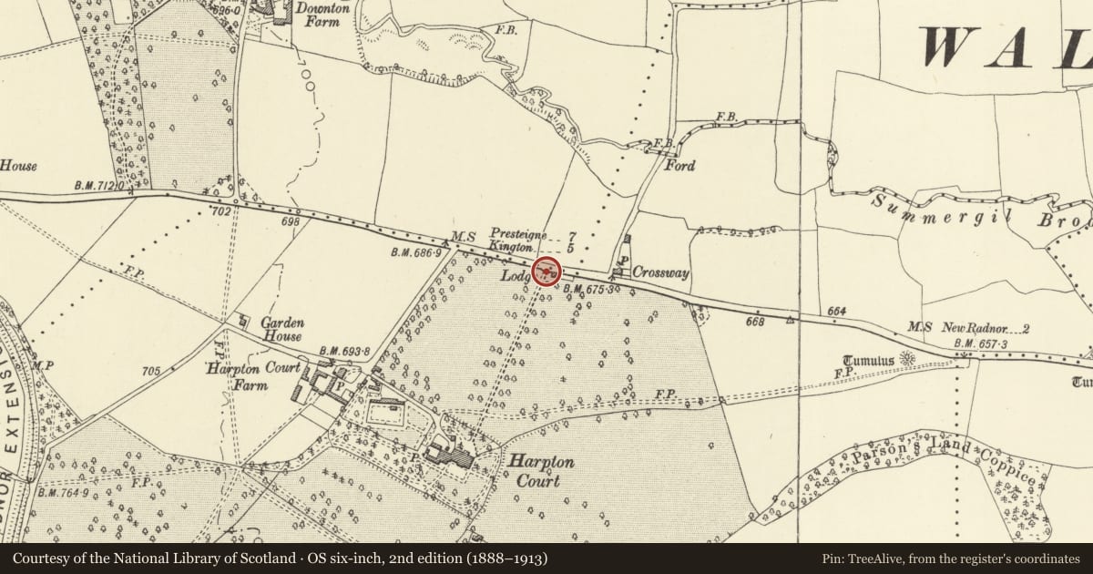
Slide toward Today to fade the historical sheet and see the modern map underneath.
David Rumsey Map Collection, Stanford LibrariesDavid Rumsey Map Collection, Stanford LibrariesDavid Rumsey Map Collection, Stanford LibrariesDavid Rumsey Map Collection, Stanford LibrariesDavid Rumsey Map Collection, Stanford Libraries
5 historical maps cover this location, the earliest the 1608 map "(13) Cambriae Typus." (David Rumsey Map Collection, Stanford Libraries).
Historical maps covering this location
- 1608 · (13) Cambriae Typus. (David Rumsey Map Collection, Stanford Libraries)
- 1636 · Cornubia : Devonia, Somersetus, Dorcestria, Wiltonia, Glocestria ... (David Rumsey Map Collection, Stanford Libraries)
- 1637 · Particular description of Wales. Cambria seu Wallia (David Rumsey Map Collection, Stanford Libraries)
- 1883 · Watershed map England, Wales 3. (David Rumsey Map Collection, Stanford Libraries)
- 1901 · Sheet 14. (David Rumsey Map Collection, Stanford Libraries)
Cadw's description
Location
By roadside, flanking former driveway and attached to west side of former lodge.
Exterior
Mid C19, classical screen swept in towards driveway entrance. Low screen wall with railings runs forward from lodge on east side of drive to meet plain ashlar pier with corniced top. Similar treatment to west side opposite, which has twin piers and rubble screen wall at outer end. Walls surmounted by railings curve back to meet twin octagonal gatepiers with ball finials. Original gate missing.
Reason for designation
Group value with lodge.
Nearby in the register
- Lodge at former North driveway to Harpton CourtDomesticunder 1 mi
- Former Granary to stable-yard at Harpton CourtDomesticunder 1 mi
- Harpton CourtDomesticunder 1 mi
- Former Stable Block to Stable-Yard at Harpton CourtDomesticunder 1 mi
Other entries of the same register within about three miles of this one, by straight line.