Cof Cymru: National Historic Assets of Wales · Wales
Lamp Post
Knighton, Powys, Wales
A Grade II listed building in Knighton, Powys, designated on 30 September 1985.
The record
- Designation
- Listed building, Grade II
- Broad class
- Gardens, Parks and Urban Spaces
- Date of designation
- 30 September 1985
- Community
- Knighton
- Unitary authority
- Powys
- Country
- Wales
- Coordinates
- 52.34368, -3.04823
- Cadw reference
- 8967
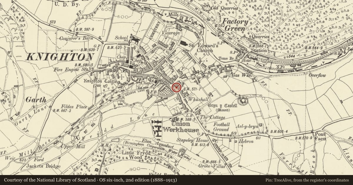
Slide toward Today to fade the historical sheet and see the modern map underneath.
David Rumsey Map Collection, Stanford LibrariesDavid Rumsey Map Collection, Stanford LibrariesDavid Rumsey Map Collection, Stanford LibrariesDavid Rumsey Map Collection, Stanford LibrariesDavid Rumsey Map Collection, Stanford Libraries
5 historical maps cover this location, the earliest the 1637 map "Particular description of Wales. Cambria seu Wallia" (David Rumsey Map Collection, Stanford Libraries).
Historical maps covering this location
- 1637 · Particular description of Wales. Cambria seu Wallia (David Rumsey Map Collection, Stanford Libraries)
- 1830 · V.3:11-15:XV.Britisches Reich. A. Kon: England. a. England ab sich: Shire:15-17, 33 (David Rumsey Map Collection, Stanford Libraries)
- 1883 · Watershed map England, Wales 3. (David Rumsey Map Collection, Stanford Libraries)
- 1899 · 180 Knighton (Hills) (David Rumsey Map Collection, Stanford Libraries)
- 1901 · Sheet 14. (David Rumsey Map Collection, Stanford Libraries)
Cadw's description
Location
On the north bank of Wylcwm Brook and forming part of a modern square opposite the Norton Arms Hotel and across Wylcwm Brook from Nos 11 and 12 Brookside.
Exterior
Dated 1867. Relocated cast-iron gothic railings and one lamp-post surviving from the former road bridge across Wylcwm Brook (construction possibly linked to the opening of the Norton Arms Hotel in same year).
Two equal lenghts of cut ironwork railings set at right-angles to each other, modern stonework and concrete plinths and piers. Uprights of continuous pointed arches under cylindrical handrails, finials to bottom rail. Two shorter sections with similar ironwork detailing to north.
Lamp-post to right end, octagonal base section, fluted stem and ornamental cap to lamp.
Raised lettering on bottom rail reads:- "S W Williams County Surveyor Radnorshire. AD 1867". Inscription on Lamp-post reads:- "W Thomas. Llanidloes Foundry".
Nearby in the register
- RailingsDomesticunder 1 mi
- Norton Arms HotelCommercialunder 1 mi
- Wylcwm House (Whittingham, Riddel and Co., Chartered Accountants)Commercialunder 1 mi
- Swan HotelCommercialunder 1 mi
Other entries of the same register within about three miles of this one, by straight line.