Cof Cymru: National Historic Assets of Wales · Wales
Boultibrooke House
Presteigne, Powys, Wales
A Grade II listed building in Presteigne, Powys, designated on 24 October 1951.
The record
- Designation
- Listed building, Grade II
- Broad class
- Domestic
- Date of designation
- 24 October 1951
- Community
- Presteigne
- Unitary authority
- Powys
- Country
- Wales
- Coordinates
- 52.28388, -3.01087
- Cadw reference
- 8927
Slide toward Today to fade the historical sheet and see the modern map underneath.
David Rumsey Map Collection, Stanford LibrariesDavid Rumsey Map Collection, Stanford LibrariesDavid Rumsey Map Collection, Stanford LibrariesDavid Rumsey Map Collection, Stanford LibrariesDavid Rumsey Map Collection, Stanford Libraries
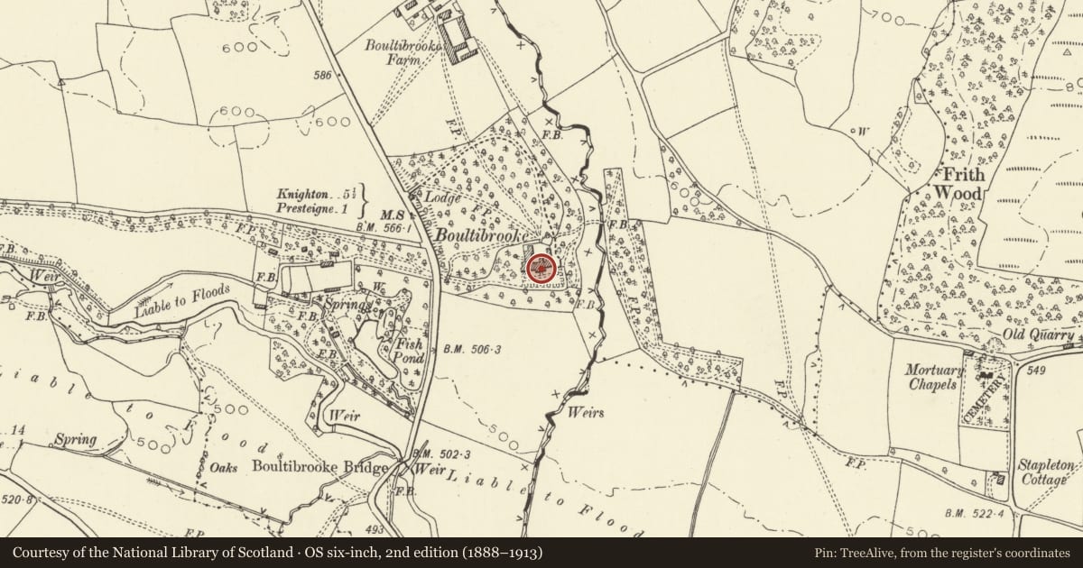
5 historical maps cover this location, the earliest the 1637 map "Particular description of Wales. Cambria seu Wallia" (David Rumsey Map Collection, Stanford Libraries).
Historical maps covering this location
- 1637 · Particular description of Wales. Cambria seu Wallia (David Rumsey Map Collection, Stanford Libraries)
- 1830 · V.3:11-15:XV.Britisches Reich. A. Kon: England. a. England ab sich: Shire:15-17, 33 (David Rumsey Map Collection, Stanford Libraries)
- 1883 · Watershed map England, Wales 3. (David Rumsey Map Collection, Stanford Libraries)
- 1899 · 180 Knighton (Hills) (David Rumsey Map Collection, Stanford Libraries)
- 1901 · Sheet 14. (David Rumsey Map Collection, Stanford Libraries)
Cadw's description
Location
Set on a wooden rise facing south towards the River Lugg.
Exterior
Composition of centre block with lower set back a symmetrical U-plan. Main 2 storey 3 window block with early C19 stucco front, hipped slate roof with end stacks, wide eaves, blind arches to outer ground floor bays. Sash windows with glazing bars in recessed timber frames, later glazed porch to centre of front. Set-back stucco wings with hipped slate roofs detailed as before, plus 5-bay arched ground floor treatment (under glazed verandah to right). The right hand wing (extended in 1872) has a 5 bay side elevation, partly 1 storey, with Gothic glazing bars to sash windows and solid porch.
Rear library extension added 1812-15 by Robert Smirke for Sir Harford Jones Brydges. Elongated red brick octagon wth top-lighting only. The interior (reached through a domed anti-room) has a coffered central dome and others with fleur-de-lys ornament, plaster cornice with egg and dart and foliage frieze.
Reason for designation
Group value.
Nearby in the register
- Coach House and Service Range at Boultibrooke HoseDomesticunder 1 mi
- Lodge to Boultibrooke HouseDomesticunder 1 mi
- Old Boultibrooke BridgeTransportunder 1 mi
- The Old Mill (formerly "New Mill House")Domesticunder 1 mi
Other entries of the same register within about three miles of this one, by straight line.