Cof Cymru: National Historic Assets of Wales · Wales
The Bull Hotel
Presteigne, Powys, Wales
A Grade II listed building in Presteigne, Powys, designated on 26 March 1985.
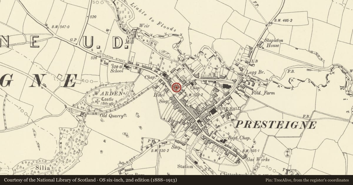
The record
- Designation
- Listed building, Grade II
- Broad class
- Commercial
- Date of designation
- 26 March 1985
- Community
- Presteigne
- Unitary authority
- Powys
- Country
- Wales
- Coordinates
- 52.27479, -3.00791
- Cadw reference
- 8910
Slide toward Today to fade the historical sheet and see the modern map underneath.
David Rumsey Map Collection, Stanford LibrariesDavid Rumsey Map Collection, Stanford LibrariesDavid Rumsey Map Collection, Stanford LibrariesDavid Rumsey Map Collection, Stanford LibrariesDavid Rumsey Map Collection, Stanford Libraries
5 historical maps cover this location, the earliest the 1637 map "Particular description of Wales. Cambria seu Wallia" (David Rumsey Map Collection, Stanford Libraries).
Historical maps covering this location
- 1637 · Particular description of Wales. Cambria seu Wallia (David Rumsey Map Collection, Stanford Libraries)
- 1830 · V.3:11-15:XV.Britisches Reich. A. Kon: England. a. England ab sich: Shire:15-17, 33 (David Rumsey Map Collection, Stanford Libraries)
- 1883 · Watershed map England, Wales 3. (David Rumsey Map Collection, Stanford Libraries)
- 1899 · 180 Knighton (Hills) (David Rumsey Map Collection, Stanford Libraries)
- 1901 · Sheet 14. (David Rumsey Map Collection, Stanford Libraries)
Cadw's description
Location
Long irregular frontage with return gable end to High Street and twin gabled range forward at right end.
History
C18 fronts in St David's Street, early C19 corner block.
Exterior
2 storeys, plus attic to corner block, white render with brick work to rear, slate roofs with projecting bargeboards to gables, tall brick stacks. 3 + 3 window frontage, paired splayed bays to centre and right, double-hung sashes with glazing bars. Entrance under later 3 bay openwork timber porch to right hand range, large garage doors in pilastered frame to left.
2 window elevation to High Street with arched 2-light window in gable, paired doors to first floor balcony and modern ground floor bays.
Reason for designation
Group value.
Nearby in the register
- St. David's HouseDomesticunder 1 mi
- Garden Walls at Warden CourtDomesticunder 1 mi
- Warden CourtDomesticunder 1 mi
- Outbuilding and Boundary Wall to NE of Warden CourtDomesticunder 1 mi
Other entries of the same register within about three miles of this one, by straight line.