Cof Cymru: National Historic Assets of Wales · Wales
Llwynderw
Llanfyllin, Powys, Wales
A Grade II listed building in Llanfyllin, Powys, designated on 25 October 1951.
The record
- Designation
- Listed building, Grade II
- Broad class
- Domestic
- Date of designation
- 25 October 1951
- Community
- Llanfyllin
- Unitary authority
- Powys
- Country
- Wales
- Coordinates
- 52.75508, -3.33281
- Cadw reference
- 8630
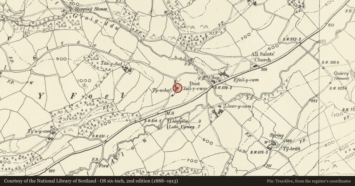
Slide toward Today to fade the historical sheet and see the modern map underneath.
David Rumsey Map Collection, Stanford LibrariesDavid Rumsey Map Collection, Stanford LibrariesDavid Rumsey Map Collection, Stanford LibrariesLlyfrgell Genedlaethol Cymru – The National Library of WalesDavid Rumsey Map Collection, Stanford Libraries
5 historical maps cover this location, the earliest the 1795 map "To Sir Watkin Williams-Wynn Bart ... the map of the six counties of North Wales is most humbly inscribed by his obedient humble servant" (Llyfrgell Genedlaethol Cymru – The National Library of Wales).
Historical maps covering this location
- 1795 · To Sir Watkin Williams-Wynn Bart ... the map of the six counties of North Wales is most… (Llyfrgell Genedlaethol Cymru – The National Library of Wales)
- 1883 · Watershed map England, Wales 3. (David Rumsey Map Collection, Stanford Libraries)
- 1897 · 137 Oswestry (Hills) (David Rumsey Map Collection, Stanford Libraries)
- 1901 · Sheet 9 and 10. (David Rumsey Map Collection, Stanford Libraries)
- 1916 · Sheet 60. Shrewsbury. (David Rumsey Map Collection, Stanford Libraries)
Cadw's description
Location
Above N side of road approx 200m W of Chapel at Tycrwyn.
History
Probably C17 timber-framed house, brick nogging.
Exterior
One storey plus attic on low plinth. Slate roof, end chimneys in brick. Three modern flat-roofed dormers. Square-panelled walls, front wall three panels high (but section of front to R has been covered over and has painted 'framing'). Entrance door roughly central, part-glazed C19 door. Two windows to L, one to R, small-pane casement glazing. Gable end to R has end posts braced to wall plate, and decorative gable with embattled tie-beam and (unlikely) date 1583.
To rear, single flat-roofed dormer; only lower part of wall has exposed framing; two modern small-pane windows. Small extension with chimney at lower end.
Interior
Kitchen (entered from L gable) has heavy beams with stopped ovolo chamfers.
Nearby in the register
- Barn at Ty BrithAgriculture and Subsistenceunder 1 mi
- LlechweddDomestic1 mi
- Braich-y-waen farm rangeAgriculture and Subsistence1 mi
- Braich-y-waen Farmhouse with attached Stable and StiesAgriculture and Subsistence1 mi
Other entries of the same register within about three miles of this one, by straight line.