Cof Cymru: National Historic Assets of Wales · Wales
Castle Inn
Pembroke, Pembrokeshire, Wales
A Grade II listed building in Pembroke, Pembrokeshire, designated on 29 July 2005.
The record
- Designation
- Listed building, Grade II
- Broad class
- Commercial
- Date of designation
- 29 July 2005
- Locality
- Pembroke
- Town
- Pembroke
- Community
- Pembroke
- Unitary authority
- Pembrokeshire
- Country
- Wales
- Coordinates
- 51.67592, -4.91735
- Cadw reference
- 84965
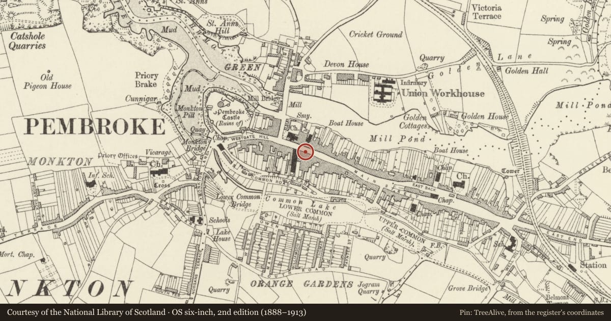
Slide toward Today to fade the historical sheet and see the modern map underneath.
David Rumsey Map Collection, Stanford LibrariesDavid Rumsey Map Collection, Stanford LibrariesDavid Rumsey Map Collection, Stanford LibrariesDavid Rumsey Map Collection, Stanford LibrariesDavid Rumsey Map Collection, Stanford Libraries
5 historical maps cover this location, the earliest the 1636 map "Cornubia : Devonia, Somersetus, Dorcestria, Wiltonia, Glocestria ..." (David Rumsey Map Collection, Stanford Libraries).
Historical maps covering this location
- 1636 · Cornubia : Devonia, Somersetus, Dorcestria, Wiltonia, Glocestria ... (David Rumsey Map Collection, Stanford Libraries)
- 1865 · England and Wales. England No. 6. (David Rumsey Map Collection, Stanford Libraries)
- 1891 · Sheet 10. Ordnance Survey of England and Wales. . (David Rumsey Map Collection, Stanford Libraries)
- 1898 · 245 Pembroke (Hills) (David Rumsey Map Collection, Stanford Libraries)
- 1901 · Sheet 13. (David Rumsey Map Collection, Stanford Libraries)
Cadw's description
Location
On the S side of Main Street some 75m E of its junction with Northgate Street.
History
Late Georgian town house, later commercial premises, the Castle Inn since c. 1952. It replaced the Pembroke Steam Brewery run from 1870s by G. Llewellyn Griffiths, taken over c. 1914-18 by James Williams and brewing ceased in 1920s. There was a small taproom that continued to the mid C20 as the Spirit Vaults.
Exterior
Inn, terraced front in painted stucco with slate close-eaved roof and brick end stacks. Brick dentilled eaves, lower than Nos. 15 and 19 adjoining. Three storeys, two-window range with horizontal channelling to upper floors and outer thin pilasters, ground floor modernised. Two hornless 6-pane top floor sashes, two hornless 12-pane first floor sashes. Ground floor has door to extreme right (to former through passage) and later C20 inn front to left with door between two projecting canted bays with overall fascia. Overlight over door, small panes to projecting bays over rubble stone bases.
Various rear additions with passage on W side.
Interior
Interior altered, long and narrow with stairs behind front left room.
Reason for designation
Included notwithstanding modern alterations to ground floor as a late Georgian terraced house front retaining original upper windows.
Nearby in the register
- Pembroke HouseCommercialunder 1 mi
- The Town HallCivilunder 1 mi
- Telephone Call-box outside Town HallCommunicationsunder 1 mi
- 18 Main StreetCommercialunder 1 mi
Other entries of the same register within about three miles of this one, by straight line.