Cof Cymru: National Historic Assets of Wales · Wales
Section of Boundary Wall at Plas Machynlleth from & including the Main Entrance up to the former coa
Machynlleth, Powys, Wales
A Grade II listed building in Machynlleth, Powys, designated on 16 February 1990.
The record
- Designation
- Listed building, Grade II
- Broad class
- Domestic
- Date of designation
- 16 February 1990
- Community
- Machynlleth
- Unitary authority
- Powys
- Country
- Wales
- Coordinates
- 52.58819, -3.85401
- Cadw reference
- 8483
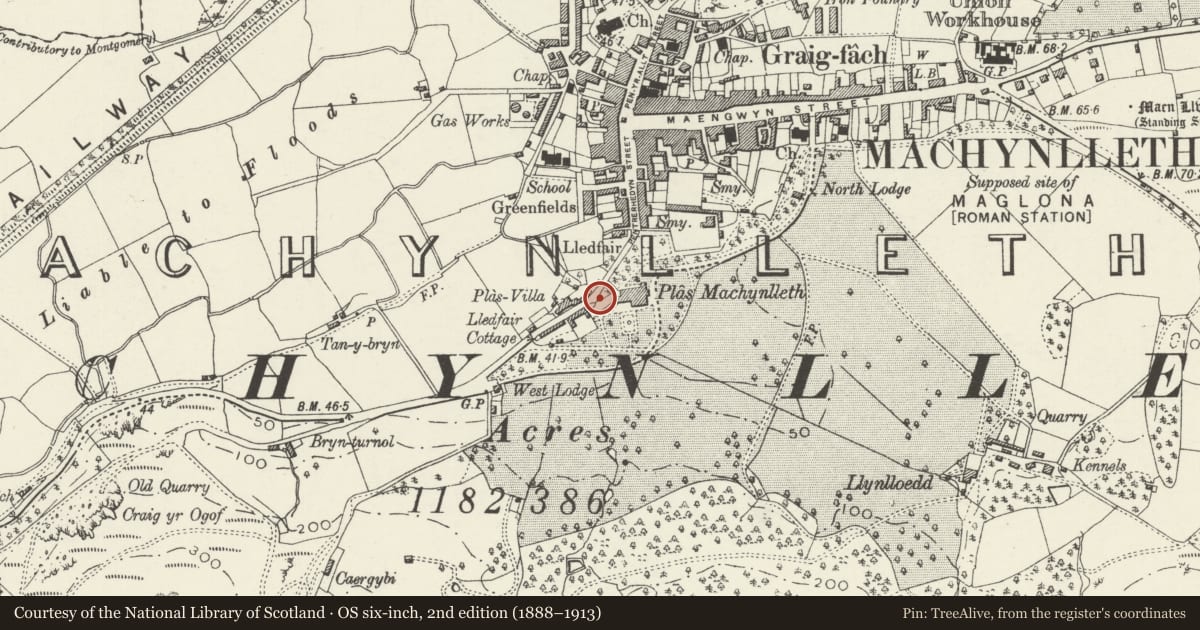
Slide toward Today to fade the historical sheet and see the modern map underneath.
David Rumsey Map Collection, Stanford LibrariesDavid Rumsey Map Collection, Stanford LibrariesDavid Rumsey Map Collection, Stanford LibrariesDavid Rumsey Map Collection, Stanford LibrariesLlyfrgell Genedlaethol Cymru – The National Library of Wales
5 historical maps cover this location, the earliest the 1795 map "To Sir Watkin Williams-Wynn Bart ... the map of the six counties of North Wales is most humbly inscribed by his obedient humble servant" (Llyfrgell Genedlaethol Cymru – The National Library of Wales).
Historical maps covering this location
- 1795 · To Sir Watkin Williams-Wynn Bart ... the map of the six counties of North Wales is most… (Llyfrgell Genedlaethol Cymru – The National Library of Wales)
- 1883 · Watershed map England, Wales 3. (David Rumsey Map Collection, Stanford Libraries)
- 1896 · Sheet 7. Ordnance Survey of England and Wales. (David Rumsey Map Collection, Stanford Libraries)
- 1899 · 149 Barmouth (Hills) (David Rumsey Map Collection, Stanford Libraries)
- 1901 · Sheet 9 and 10. (David Rumsey Map Collection, Stanford Libraries)
Cadw's description
Location
Bordering the park of Plas Machynlleth to W and running from the present main entrance as far as the former coach house and stables (Plas Kennels).
History
Probably erected at the time of the l850's remodelling of the Plas by the Londonderry family.
Exterior
Not contemporary with the former coach house and stable range as masonry break is visible. Simple low gate piers to main entrance (gates removed). The boundary wall is curved inwards to SW and splayed back to NE at the entrance; beyond this corner to NE the wall has been later rebuilt. Rubble wall with flat coping.
Reason for designation
Included for group value with Plas Machynlleth and associated listed items; also for its townscape value on the southerly approach to the town.
Nearby in the register
- Section of rubble wall bordering the outer Entrance Courtyard between the former coach house & stablDomesticunder 1 mi
- Former Coach House and Stables to Plas Machynlleth (Plas Kennels)Domesticunder 1 mi
- Fountain in the Gardens of Plas MachynllethGardens, Parks and Urban Spacesunder 1 mi
- Plas MachynllethDomesticunder 1 mi
Other entries of the same register within about three miles of this one, by straight line.