Cof Cymru: National Historic Assets of Wales · Wales
Fountain in the Gardens of Plas Machynlleth
Machynlleth, Powys, Wales
A Grade II listed building in Machynlleth, Powys, designated on 19 November 1990.
The record
- Designation
- Listed building, Grade II
- Broad class
- Gardens, Parks and Urban Spaces
- Date of designation
- 19 November 1990
- Community
- Machynlleth
- Unitary authority
- Powys
- Country
- Wales
- Coordinates
- 52.58789, -3.85331
- Cadw reference
- 8500
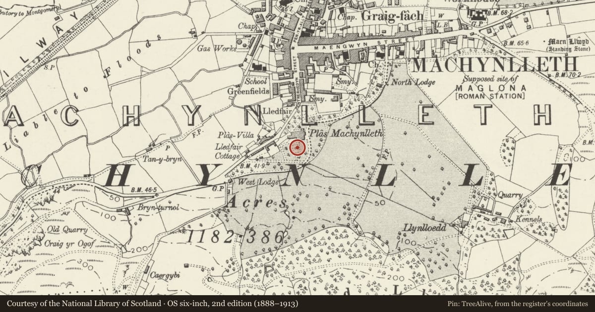
Slide toward Today to fade the historical sheet and see the modern map underneath.
David Rumsey Map Collection, Stanford LibrariesDavid Rumsey Map Collection, Stanford LibrariesDavid Rumsey Map Collection, Stanford LibrariesDavid Rumsey Map Collection, Stanford LibrariesLlyfrgell Genedlaethol Cymru – The National Library of Wales
5 historical maps cover this location, the earliest the 1795 map "To Sir Watkin Williams-Wynn Bart ... the map of the six counties of North Wales is most humbly inscribed by his obedient humble servant" (Llyfrgell Genedlaethol Cymru – The National Library of Wales).
Historical maps covering this location
- 1795 · To Sir Watkin Williams-Wynn Bart ... the map of the six counties of North Wales is most… (Llyfrgell Genedlaethol Cymru – The National Library of Wales)
- 1883 · Watershed map England, Wales 3. (David Rumsey Map Collection, Stanford Libraries)
- 1896 · Sheet 7. Ordnance Survey of England and Wales. (David Rumsey Map Collection, Stanford Libraries)
- 1899 · 149 Barmouth (Hills) (David Rumsey Map Collection, Stanford Libraries)
- 1901 · Sheet 9 and 10. (David Rumsey Map Collection, Stanford Libraries)
Cadw's description
Location
In the centre of the planned area known as the Rose Garden; immediately to S of Plas Machynlleth.
History
Later Cl9 (shown on 1st edition OS map, surveyed in 1887).
Exterior
Stone fountain in circular pond. Classical dolphins below tall finial from which springs the water. Simply scalloped bowl on square plinth with fishscale band to base.
Reason for designation
Included for group value with Plas Machynlleth and associated listed items.
Nearby in the register
- Pedestal and Bust of Marchioness ofLondonderry in the gardens of Plas MachynllethCommemorativeunder 1 mi
- Section of rubble wall bordering the outer Entrance Courtyard between the former coach house & stablDomesticunder 1 mi
- Plas MachynllethDomesticunder 1 mi
- Section of Boundary Wall at Plas Machynlleth from & including the Main Entrance up to the former coaDomesticunder 1 mi
Other entries of the same register within about three miles of this one, by straight line.