Cof Cymru: National Historic Assets of Wales · Wales
Bryn dulas
Llangurig, Powys, Wales
A Grade II listed building in Rhos y Pentref, Llangurig, Powys, designated on 24 March 2005.
The record
- Designation
- Listed building, Grade II
- Broad class
- No class recorded
- Date of designation
- 24 March 2005
- Locality
- Rhos y Pentref
- Community
- Llangurig
- Unitary authority
- Powys
- Country
- Wales
- Coordinates
- 52.43094, -3.54424
- Cadw reference
- 84286
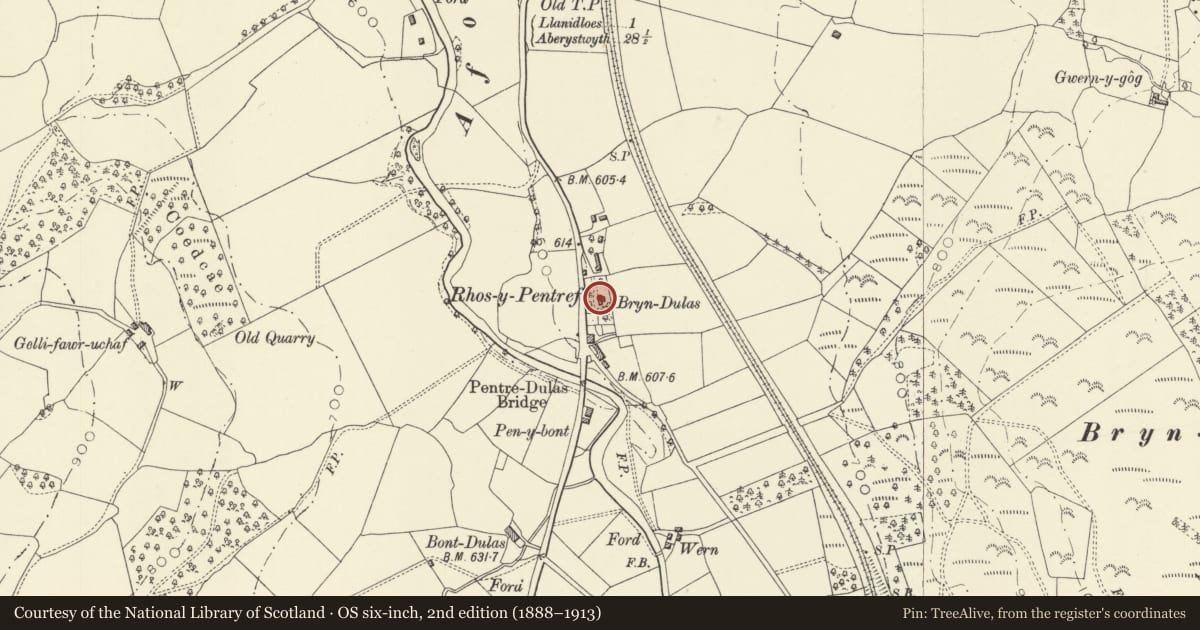
Slide toward Today to fade the historical sheet and see the modern map underneath.
David Rumsey Map Collection, Stanford LibrariesDavid Rumsey Map Collection, Stanford LibrariesDavid Rumsey Map Collection, Stanford LibrariesDavid Rumsey Map Collection, Stanford LibrariesDavid Rumsey Map Collection, Stanford Libraries
5 historical maps cover this location, the earliest the 1608 map "(13) Cambriae Typus." (David Rumsey Map Collection, Stanford Libraries).
Historical maps covering this location
- 1608 · (13) Cambriae Typus. (David Rumsey Map Collection, Stanford Libraries)
- 1637 · Particular description of Wales. Cambria seu Wallia (David Rumsey Map Collection, Stanford Libraries)
- 1883 · Watershed map England, Wales 3. (David Rumsey Map Collection, Stanford Libraries)
- 1899 · 164 Llanidloes (Hills) (David Rumsey Map Collection, Stanford Libraries)
- 1901 · Sheet 14. (David Rumsey Map Collection, Stanford Libraries)
Cadw's description
Location
Set in gardens and reached by a short drive off the A470.
History
A villa of c1850 which was the rectory to Llangurig church some miles away, until a new rectory was built in Llangurig village in the late C19. The site is said to have had a long association with the church, and the villa appears to be a remodelling of an earlier house; a house is shown in this location on the Llangurig Tithe map of 1846.
Exterior
Symmetrical 2-storey 3-window house with central gabled advanced bay in mild Tudor-gothic style. Plastered over brick under a slate roof with decorative yellow brick end stacks, each with paired octagonal shafts. Gabled open porch in front of advanced bay, the gable with decorative barge boards with pendants and pendant finials, supported on round columns. Inside porch, double panelled doors with Tudor-arched fanlight with decorative lead glazing. The gable to the advanced bay has similar decorative barge boards, and an incised cross to the apex. The windows are paired sashes with margin glazing, each divided by a moulded mullion. They have fine sandstone hoodmoulds, except for the outer windows of the 1st floor which are immediately under the eaves. The gable ends of the house have decorative open-work barge boards; single window to N end, no openings to S end. Lower 2-storey rear wing with yellow brick end stack.
Interior
Interior not seen at resurvey.
Reason for designation
Listed as a good C19 villa and rectory, which retains its character and detail.
Nearby in the register
- Multi-purpose Farm Building at Bryn dulasNo class recordedunder 1 mi
- GlanyrafonNo class recordedunder 1 mi
- Cwmbelan MillNo class recordedunder 1 mi
- Zion Baptist Chapel and attached chapel houseReligious, Ritual and Funeraryunder 1 mi
Other entries of the same register within about three miles of this one, by straight line.