Cof Cymru: National Historic Assets of Wales · Wales
Chimney Stack W of Brynlludw
Llanidloes Without, Powys, Wales
A Grade II listed building in Van, Llanidloes Without, Powys, designated on 17 November 2004.
The record
- Designation
- Listed building, Grade II
- Broad class
- No class recorded
- Date of designation
- 17 November 2004
- Locality
- Van
- Community
- Llanidloes Without
- Unitary authority
- Powys
- Country
- Wales
- Coordinates
- 52.47920, -3.56256
- Cadw reference
- 83242
Slide toward Today to fade the historical sheet and see the modern map underneath.
David Rumsey Map Collection, Stanford LibrariesDavid Rumsey Map Collection, Stanford LibrariesDavid Rumsey Map Collection, Stanford LibrariesDavid Rumsey Map Collection, Stanford LibrariesDavid Rumsey Map Collection, Stanford Libraries
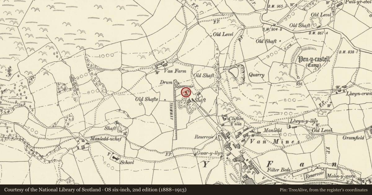
5 historical maps cover this location, the earliest the 1608 map "(13) Cambriae Typus." (David Rumsey Map Collection, Stanford Libraries).
Historical maps covering this location
- 1608 · (13) Cambriae Typus. (David Rumsey Map Collection, Stanford Libraries)
- 1637 · Particular description of Wales. Cambria seu Wallia (David Rumsey Map Collection, Stanford Libraries)
- 1883 · Watershed map England, Wales 3. (David Rumsey Map Collection, Stanford Libraries)
- 1899 · 164 Llanidloes (Hills) (David Rumsey Map Collection, Stanford Libraries)
- 1901 · Sheet 14. (David Rumsey Map Collection, Stanford Libraries)
Cadw's description
Location
Located off the W side of a lane which leads to Van Farm. Immediately W of Brynlludw bungalow.
History
The Van mines were exploited for lead from 1866, and were managed by Captain William Williams and owned by Earl Vane. The first deep shaft was operated by a winding engine, and this boiler stack was connected to it; some rubble foundations of the engine house are still visible at ground level. A new shaft, known as Seaham's, was sunk c1870 a short distance to the S; both engine houses are shown on the Ordnance Survey of 1903.
Exterior
Tall tapering octagonal stack of yellow firebrick which stands to approximately two-thirds of its original height. The shaft rests on a square brick base with moulded capstone.
Reason for designation
Listed as a prominent survival from an important regional industry, of which little else remains above ground level, and for group value with the full-height boiler stack just to its S.
Nearby in the register
- Chimney Stack SW of BrynlludwIndustrialunder 1 mi
- Pen y CastellHillfortunder 1 mi
- Village Institute, VanNo class recordedunder 1 mi
- Penyclun Lead MineLead Mineunder 1 mi
Other entries of the same register within about three miles of this one, by straight line.