Cof Cymru: National Historic Assets of Wales · Wales
Village Institute, Van
Llanidloes Without, Powys, Wales
A Grade II listed building in Van, Llanidloes Without, Powys, designated on 17 November 2004.
The record
- Designation
- Listed building, Grade II
- Broad class
- No class recorded
- Date of designation
- 17 November 2004
- Locality
- Van
- Community
- Llanidloes Without
- Unitary authority
- Powys
- Country
- Wales
- Coordinates
- 52.47466, -3.54828
- Cadw reference
- 83250
Slide toward Today to fade the historical sheet and see the modern map underneath.
David Rumsey Map Collection, Stanford LibrariesDavid Rumsey Map Collection, Stanford LibrariesDavid Rumsey Map Collection, Stanford LibrariesDavid Rumsey Map Collection, Stanford LibrariesDavid Rumsey Map Collection, Stanford Libraries
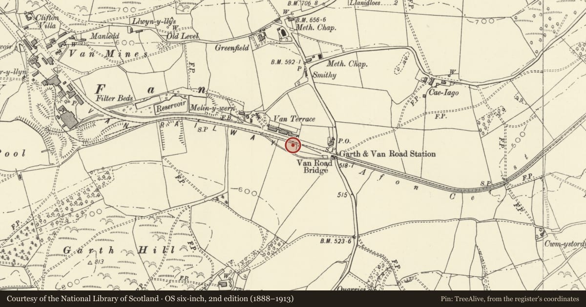
5 historical maps cover this location, the earliest the 1608 map "(13) Cambriae Typus." (David Rumsey Map Collection, Stanford Libraries).
Historical maps covering this location
- 1608 · (13) Cambriae Typus. (David Rumsey Map Collection, Stanford Libraries)
- 1637 · Particular description of Wales. Cambria seu Wallia (David Rumsey Map Collection, Stanford Libraries)
- 1883 · Watershed map England, Wales 3. (David Rumsey Map Collection, Stanford Libraries)
- 1899 · 164 Llanidloes (Hills) (David Rumsey Map Collection, Stanford Libraries)
- 1901 · Sheet 14. (David Rumsey Map Collection, Stanford Libraries)
Cadw's description
Location
Located in the village, to the W of the post-office.
History
A probably Edwardian village institute (post-dating 1903 Ordance Survey, but probably pre-dating the First World War). The small settlement at Van had sprung up in association with the development of lead mining in the area.
Exterior
Single-storey institute. Main range with 2 outer gabled wings advanced to front. Weather-boarded on a brick plinth under a corrugated steel roof. Truncated lateral brick stack to centre of main range, with triangular pediment beneath the eaves; the stack is replaced by a steel cupola to ridge. Detail includes moulded boarded eaves, those to the gables projecting and bracketed. Moulded wooden small-pane windows, either single-lights with transoms or cross-windows. Entrance to gable end of L wing; moulded wooden door case with cornice supported on scrolled brackets, beneath which is a sign reading 'Village Institute'. Inset half-glazed panelled double doors with overlight; boarded canted reveals and quarry tile floor. Single-light windows flanking entrance. Against the L-return of the wing is a large 9-pane window, R of which is a shallow lean-to with small lights, probably late-C20, To the main range are 2 cross-windows to the L of the stack, and 1 cross-window and 2 single lights R of the stack. R wing has half-glazed panelled door to L-return and a cross-window flanked by side lights to gable end. Small gabled block against R-return. The rear wall appears to have been rebuilt in red brick, but the detail was not seen.
Interior
Interior not seen.
Reason for designation
Listed as a scarce example of an early C20 village institute which retains strong character, notwithstanding the renewal of some detail.
Nearby in the register
- The Garth FarmhouseNo class recordedunder 1 mi
- Pen y CastellHillfortunder 1 mi
- Farm Ranges at Cwm dylluanNo class recordedunder 1 mi
- Cwm dylluanNo class recordedunder 1 mi
Other entries of the same register within about three miles of this one, by straight line.