Cof Cymru: National Historic Assets of Wales · Wales
Penyclun Lead Mine
Llanidloes Without, Powys, Wales
A scheduled monument in Llanidloes Without, Powys, recorded as Lead Mine (Post Medieval/Modern).
The record
- Designation
- Scheduled monument
- Site type
- Lead Mine
- Period
- Post Medieval/Modern
- Date of designation
- 11 August 1998
- Community
- Llanidloes Without
- Unitary authority
- Powys
- Country
- Wales
- Coordinates (centre of the scheduled area)
- 52.47322, -3.57536
- SAM number
- MG246
- Cadw record number
- 3523
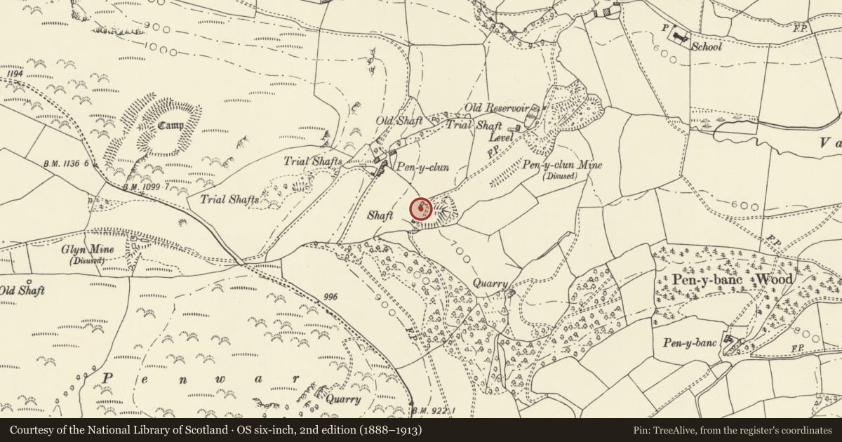
Slide toward Today to fade the historical sheet and see the modern map underneath.
David Rumsey Map Collection, Stanford LibrariesDavid Rumsey Map Collection, Stanford LibrariesDavid Rumsey Map Collection, Stanford LibrariesBayerische Staatsbibliothek, MunichDavid Rumsey Map Collection, Stanford Libraries
5 historical maps cover this location, the earliest the 1588 map "Ortelius, Abraham: Theatro De La Tierra Universal. 0" (Bayerische Staatsbibliothek, Munich).
Historical maps covering this location
- 1588 · Ortelius, Abraham: Theatro De La Tierra Universal. 0 (Bayerische Staatsbibliothek, Munich)
- 1608 · (13) Cambriae Typus. (David Rumsey Map Collection, Stanford Libraries)
- 1883 · Watershed map England, Wales 3. (David Rumsey Map Collection, Stanford Libraries)
- 1899 · 164 Llanidloes (Hills) (David Rumsey Map Collection, Stanford Libraries)
- 1901 · Sheet 14. (David Rumsey Map Collection, Stanford Libraries)
Cadw's description
Summary description and reason for designation
The following provides a general description of the Scheduled Ancient Monument.
A compact group of well-preserved lead mining remains associated with Penyclun mine, developed in the 1850s and 1860s with little later alteration. The focal point of the group is a small beam engine house with chimney in a nearly complete condition. The remains of the boiler house can be seen against this, together with a small reservoir and leat to supply it with water. A waterwheel pit also survives nearby, and a level and an open shaft are visible to the west. The scheduled area is bounded by a fence line on the south, and extends northwards to include the shaft and a building platform. Of national importance as an exceptionally compact and complete group of features form a well preserved mid nineteenth century lead mine.
Nearby in the register
- Pen y Clun CampHillfortunder 1 mi
- Stable and Cart-shed at Glyn ClywedogNo class recordedunder 1 mi
- Glyn ClywedogDomesticunder 1 mi
- Chimney Stack SW of BrynlludwIndustrialunder 1 mi
Other entries of the same register within about three miles of this one, by straight line.