Cof Cymru: National Historic Assets of Wales · Wales
Bridge, gatepiers and railings at S end of Manor Drive
Glynneath, Neath Port Talbot, Wales
A Grade II listed building in Aberpergwm, Neath, Glynneath, Neath Port Talbot, designated on 30 January 2004.
The record
- Designation
- Listed building, Grade II
- Broad class
- Transport
- Date of designation
- 30 January 2004
- Locality
- Aberpergwm
- Town
- Neath
- Community
- Glynneath
- Unitary authority
- Neath Port Talbot
- Country
- Wales
- Coordinates
- 51.74199, -3.63642
- Cadw reference
- 82448
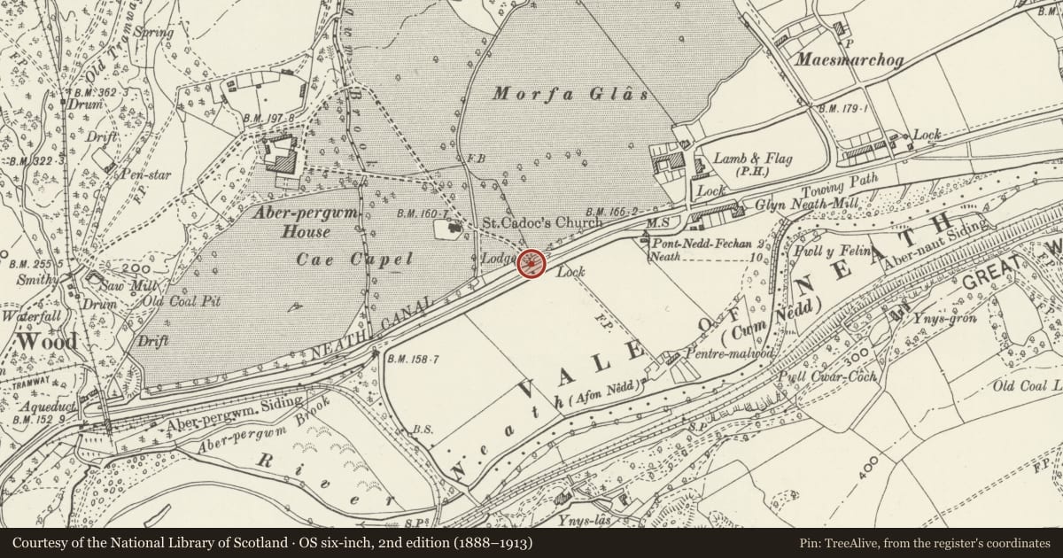
Slide toward Today to fade the historical sheet and see the modern map underneath.
David Rumsey Map Collection, Stanford LibrariesDavid Rumsey Map Collection, Stanford LibrariesDavid Rumsey Map Collection, Stanford LibrariesDavid Rumsey Map Collection, Stanford LibrariesDavid Rumsey Map Collection, Stanford Libraries
5 historical maps cover this location, the earliest the 1608 map "(13) Cambriae Typus." (David Rumsey Map Collection, Stanford Libraries).
Historical maps covering this location
- 1608 · (13) Cambriae Typus. (David Rumsey Map Collection, Stanford Libraries)
- 1636 · Cornubia : Devonia, Somersetus, Dorcestria, Wiltonia, Glocestria ... (David Rumsey Map Collection, Stanford Libraries)
- 1637 · The fourth table of England. Cornub. Devonia, Somerset etc. (David Rumsey Map Collection, Stanford Libraries)
- 1830 · V.3:11-15:XV. Britisches Reich. A. Kon: England. b. Frstenthum Wales: Shire: 37-40 (David Rumsey Map Collection, Stanford Libraries)
- 1898 · 231 Merthyr Tydfil (Hills) (David Rumsey Map Collection, Stanford Libraries)
Cadw's description
Location
At the SE end of the drive to Aberpergwm House near its junction with the B4242.
History
Gatepiers and railings extending over a low bridge over Neath canal at junction of former drive to Aberpergwm with main road, probably early C19.
Exterior
Two very tall gatepiers of some 4-5m height, of large blocks of sandstone ashlar each with raised plinth and stepped cap. Attached on one side of each and running back to bridge are iron railings with square neck-rings and rounded ends and acorn finials to larger stanchions. Four sections each side, then a slight step inward for very low bridge over canal, the roadway carried on iron girders apparently. Similar railings in 3 similar sections with a small last section, on low stone coping, and ended against rubble stone plain piers.
Reason for designation
Included for the special interest of the good quality wrought ironwork and unusually tall stone piers at the entrance to a once important country house.
Nearby in the register
- Gate and railings and churchyard wall to SE of Church of St CadocReligious, Ritual and Funeraryunder 1 mi
- Church of Saint CadocReligious, Ritual and Funeraryunder 1 mi
- Memorial to Jane Williams in the churchyarde of the Church of Saint CadocCommemorativeunder 1 mi
- Gates across driveway at Aberpergwm HouseDomesticunder 1 mi
Other entries of the same register within about three miles of this one, by straight line.