Cof Cymru: National Historic Assets of Wales · Wales
Gate and railings and churchyard wall to SE of Church of St Cadoc
Glynneath, Neath Port Talbot, Wales
A Grade II listed building in Aberpergwm, Neath, Glynneath, Neath Port Talbot, designated on 30 January 2004.
The record
- Designation
- Listed building, Grade II
- Broad class
- Religious, Ritual and Funerary
- Date of designation
- 30 January 2004
- Locality
- Aberpergwm
- Town
- Neath
- Community
- Glynneath
- Unitary authority
- Neath Port Talbot
- Country
- Wales
- Coordinates
- 51.74263, -3.63814
- Cadw reference
- 82447
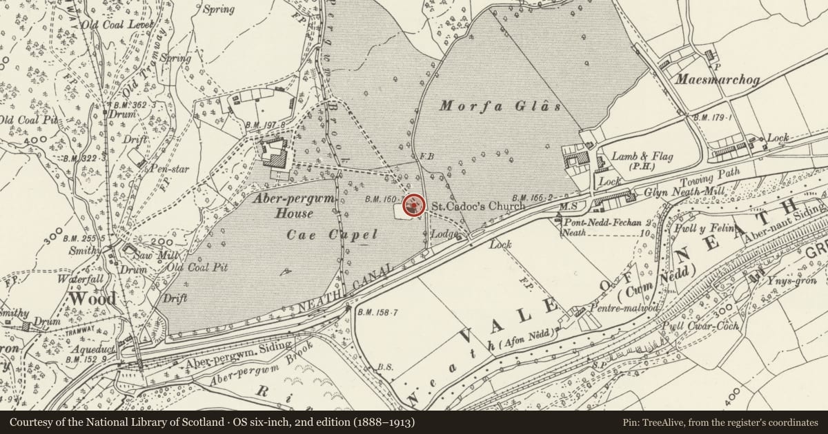
Slide toward Today to fade the historical sheet and see the modern map underneath.
David Rumsey Map Collection, Stanford LibrariesDavid Rumsey Map Collection, Stanford LibrariesDavid Rumsey Map Collection, Stanford LibrariesDavid Rumsey Map Collection, Stanford LibrariesDavid Rumsey Map Collection, Stanford Libraries
5 historical maps cover this location, the earliest the 1608 map "(13) Cambriae Typus." (David Rumsey Map Collection, Stanford Libraries).
Historical maps covering this location
- 1608 · (13) Cambriae Typus. (David Rumsey Map Collection, Stanford Libraries)
- 1636 · Cornubia : Devonia, Somersetus, Dorcestria, Wiltonia, Glocestria ... (David Rumsey Map Collection, Stanford Libraries)
- 1637 · The fourth table of England. Cornub. Devonia, Somerset etc. (David Rumsey Map Collection, Stanford Libraries)
- 1830 · V.3:11-15:XV. Britisches Reich. A. Kon: England. b. Frstenthum Wales: Shire: 37-40 (David Rumsey Map Collection, Stanford Libraries)
- 1898 · 231 Merthyr Tydfil (Hills) (David Rumsey Map Collection, Stanford Libraries)
Cadw's description
Location
Churchyard wall to SE and railings to E and NE of Church of Saint Cadoc.
History
Churchyard wall to SE and railings to E and NE of church, probably earlier C19, possibly from date of new chancel c1836-41.
Exterior
Churchyard gates and railings, spearhead wrought iron railings set in C20 concrete. Gates NE of church with two openwork piers the front and backs with vertical bars to lowest panels, then diagonal cross, then intersected half circles, and top of 4 scrolls joined under urn. Double gates with dog-bars, and top rails ramped down to meeting rail. Short length of rails to right, long length to left joining to a length of some 11 m of rubble wall with broad ogee-arched recess on churchyard face with rock-faced stone voussoirs flanked by raised piers of rockfaced stone with rockfaced pyramid caps.
Reason for designation
Included as good example of earlier C19 ironwork and for group value with the Church of Saint Cadoc.
Nearby in the register
- Church of Saint CadocReligious, Ritual and Funeraryunder 1 mi
- Memorial to Jane Williams in the churchyarde of the Church of Saint CadocCommemorativeunder 1 mi
- Bridge, gatepiers and railings at S end of Manor DriveTransportunder 1 mi
- Gates across driveway at Aberpergwm HouseDomesticunder 1 mi
Other entries of the same register within about three miles of this one, by straight line.