Cof Cymru: National Historic Assets of Wales · Wales
Gates across driveway at Aberpergwm House
Glynneath, Neath Port Talbot, Wales
A Grade II listed building in Aberpergwm, Neath, Glynneath, Neath Port Talbot, designated on 11 December 1985.
The record
- Designation
- Listed building, Grade II
- Broad class
- Domestic
- Date of designation
- 11 December 1985
- Locality
- Aberpergwm
- Town
- Neath
- Community
- Glynneath
- Unitary authority
- Neath Port Talbot
- Country
- Wales
- Coordinates
- 51.74336, -3.64038
- Cadw reference
- 11847
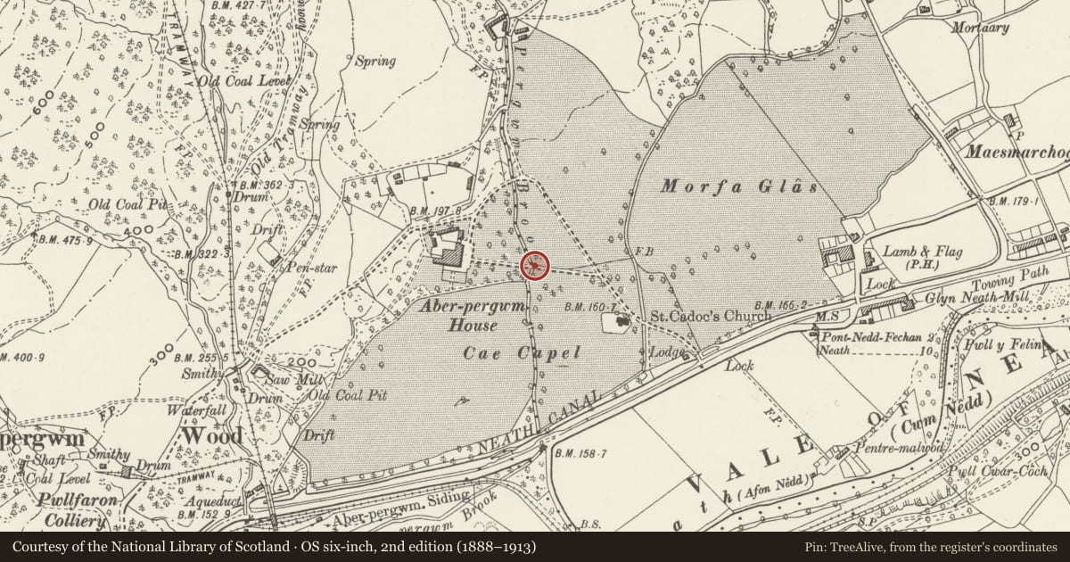
Slide toward Today to fade the historical sheet and see the modern map underneath.
David Rumsey Map Collection, Stanford LibrariesDavid Rumsey Map Collection, Stanford LibrariesDavid Rumsey Map Collection, Stanford LibrariesDavid Rumsey Map Collection, Stanford LibrariesDavid Rumsey Map Collection, Stanford Libraries
5 historical maps cover this location, the earliest the 1636 map "Cornubia : Devonia, Somersetus, Dorcestria, Wiltonia, Glocestria ..." (David Rumsey Map Collection, Stanford Libraries).
Historical maps covering this location
- 1636 · Cornubia : Devonia, Somersetus, Dorcestria, Wiltonia, Glocestria ... (David Rumsey Map Collection, Stanford Libraries)
- 1637 · The fourth table of England. Cornub. Devonia, Somerset etc. (David Rumsey Map Collection, Stanford Libraries)
- 1830 · V.3:11-15:XV. Britisches Reich. A. Kon: England. b. Frstenthum Wales: Shire: 37-40 (David Rumsey Map Collection, Stanford Libraries)
- 1898 · 231 Merthyr Tydfil (Hills) (David Rumsey Map Collection, Stanford Libraries)
- 1898 · 231 Merthyr Tydfil (Outline) (David Rumsey Map Collection, Stanford Libraries)
Cadw's description
Location
Reached along driveway past Church of Saint Cadoc to NW of B4242.
History
Railings of ornate scrolled wrought iron, probably later C18, from which the three gates were stolen in late C20.
Exterior
Wrought iron gatepiers to broad gated drive with matching wrought iron surrounds to pedestrian gateways each side. Two large openwork gatepiers with scrollwork infill and cast-iron concave-pyramid plinths to ball finials, supporting C20 large double gates. To each side are narrow C20 pedestrian gates (welded shut) in original surround with outer side piers matching scrollwork of main piers with ball finial, but piers are flat rather than 4-sided and shorter. Scrolled ironwork above pedestrian gates against sides of main piers. A short curve of iron railings each side with another panel of wrought ironwork with finial at inner end of each, stone pier at outer end.
Reason for designation
Included despite loss of the gates as a good example of late C18 blacksmith work.
Nearby in the register
- Aberpergwm HouseDomesticunder 1 mi
- Memorial to Jane Williams in the churchyarde of the Church of Saint CadocCommemorativeunder 1 mi
- Church of Saint CadocReligious, Ritual and Funeraryunder 1 mi
- Gate and railings and churchyard wall to SE of Church of St CadocReligious, Ritual and Funeraryunder 1 mi
Other entries of the same register within about three miles of this one, by straight line.