Cof Cymru: National Historic Assets of Wales · Wales
Railings and gate to Parkfield House
Graig, Newport, Wales
A Grade II listed building in Lower Machen, Newport, Graig, designated on 23 October 1973.
The record
- Designation
- Listed building, Grade II
- Broad class
- No class recorded
- Date of designation
- 23 October 1973
- Locality
- Lower Machen
- Town
- Newport
- Community
- Graig
- Unitary authority
- Newport
- Country
- Wales
- Coordinates
- 51.58585, -3.11555
- Cadw reference
- 81800
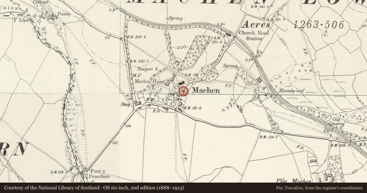
Slide toward Today to fade the historical sheet and see the modern map underneath.
David Rumsey Map Collection, Stanford LibrariesDavid Rumsey Map Collection, Stanford LibrariesDavid Rumsey Map Collection, Stanford LibrariesDavid Rumsey Map Collection, Stanford LibrariesDavid Rumsey Map Collection, Stanford Libraries
5 historical maps cover this location, the earliest the 1636 map "Cornubia : Devonia, Somersetus, Dorcestria, Wiltonia, Glocestria ..." (David Rumsey Map Collection, Stanford Libraries).
Historical maps covering this location
- 1636 · Cornubia : Devonia, Somersetus, Dorcestria, Wiltonia, Glocestria ... (David Rumsey Map Collection, Stanford Libraries)
- 1865 · England and Wales. England No. 6. (David Rumsey Map Collection, Stanford Libraries)
- 1895 · Sheet 11. Ordnance Survey of England and Wales. (David Rumsey Map Collection, Stanford Libraries)
- 1906 · 249 Newport (Hills) (David Rumsey Map Collection, Stanford Libraries)
- 1913 · Sheet 102. Newport. (David Rumsey Map Collection, Stanford Libraries)
Cadw's description
Location
On the E side of the road N through Lower Machen village, opposite the gates to the churchyard.
History
Railings and gate to former church school of 1834, probably contemporary.
Exterior
Cast-iron railings on dwarf rubble stone retaining wall with sandstone coping. Wall curves out to right to tooled sandstone end pier and ends at left at rubble wall with sandstone cap on low pier. Spearhead iron rails, larger column-type standards and fine square openwork gatepiers to centre gateway with cornices, concave pyramid caps and finials. Gate has different spearheads and dog-bars. On wall to left is a cast-iron cap with acorn finial similar to those on gatepiers of Machen House.
Reason for designation
Included as good set of C19 iron railings with fine openwork cast-iron gatepiers.
Nearby in the register
- Parkfield HouseDomesticunder 1 mi
- Churchyard gates and piers to the Church of St MichaelNo class recordedunder 1 mi
- Trough and surround in wall to The CourtNo class recordedunder 1 mi
- Churchyard cross at the Church of St MichaelNo class recordedunder 1 mi
Other entries of the same register within about three miles of this one, by straight line.