Cof Cymru: National Historic Assets of Wales · Wales
Parkfield House
Graig, Newport, Wales
A Grade II listed building in Lower Machen, Newport, Graig, designated on 23 October 1973.
The record
- Designation
- Listed building, Grade II
- Broad class
- Domestic
- Date of designation
- 23 October 1973
- Locality
- Lower Machen
- Town
- Newport
- Community
- Graig
- Unitary authority
- Newport
- Country
- Wales
- Coordinates
- 51.58582, -3.11536
- Cadw reference
- 3050
Slide toward Today to fade the historical sheet and see the modern map underneath.
David Rumsey Map Collection, Stanford LibrariesDavid Rumsey Map Collection, Stanford LibrariesDavid Rumsey Map Collection, Stanford LibrariesDavid Rumsey Map Collection, Stanford LibrariesDavid Rumsey Map Collection, Stanford Libraries
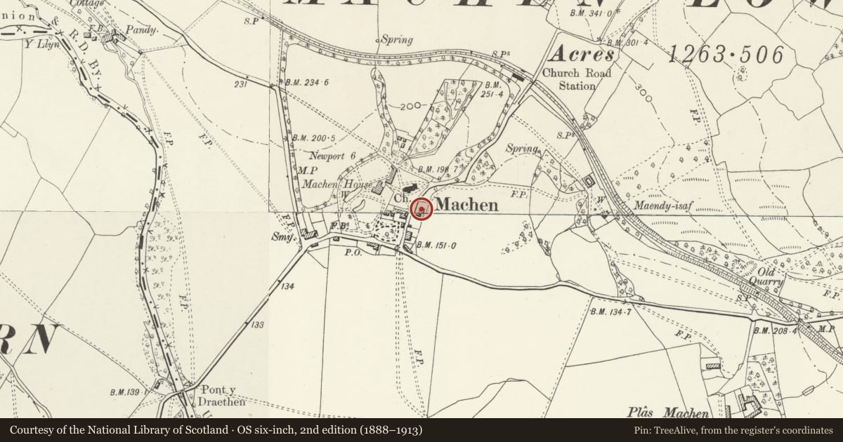
5 historical maps cover this location, the earliest the 1636 map "Cornubia : Devonia, Somersetus, Dorcestria, Wiltonia, Glocestria ..." (David Rumsey Map Collection, Stanford Libraries).
Historical maps covering this location
- 1636 · Cornubia : Devonia, Somersetus, Dorcestria, Wiltonia, Glocestria ... (David Rumsey Map Collection, Stanford Libraries)
- 1865 · England and Wales. England No. 6. (David Rumsey Map Collection, Stanford Libraries)
- 1895 · Sheet 11. Ordnance Survey of England and Wales. (David Rumsey Map Collection, Stanford Libraries)
- 1906 · 249 Newport (Hills) (David Rumsey Map Collection, Stanford Libraries)
- 1913 · Sheet 102. Newport. (David Rumsey Map Collection, Stanford Libraries)
Cadw's description
Location
On the E side of the road N through Lower Machen village, opposite the gates to the churchyard.
History
Former Lower Machen National School established in 1834 by the Rev. C.A.S. Morgan of Machen House, vicar of the parish. An unusual design mixing simple Tudor to Gothic detail with Italianate hipped roofs and windows.
Exterior
Former church school established 1834, painted roughcast with ashlar dressings and imitation slates to hipped roofs. Taller rear schoolroom with low single-storey parallel domestic range across front. with hipped lean-to roof against side wall of schoolroom. Front range of 5 bays with ashlar quoins and chamfered surrounds to big casement-pair windows. Centre ashlar porch in Tudor style with shouldered coped parapet with centre shallow gable over shield with stag-head crest. Four-centred pointed arched doorway with sunk spandrel panels and double panelled doors. Schoolroom has 2 large yellow brick eaves stacks above front range roof and is said to have pointed windows to rear with centre gabled porch.
Interior
Interior not inspected.
Reason for designation
Included as an unusual earlier C19 church school, with schoolroom fronted by domestic range, of architectural quality.
Nearby in the register
- Railings and gate to Parkfield HouseNo class recordedunder 1 mi
- Churchyard gates and piers to the Church of St MichaelNo class recordedunder 1 mi
- Trough and surround in wall to The CourtNo class recordedunder 1 mi
- Churchyard cross at the Church of St MichaelNo class recordedunder 1 mi
Other entries of the same register within about three miles of this one, by straight line.