Cof Cymru: National Historic Assets of Wales · Wales
Blaenbeidiog
Llangwyryfon, Ceredigion, Wales
A Grade II listed building in Trefenter, Aberystwyth, Llangwyryfon, Ceredigion, designated on 15 August 2003.
The record
- Designation
- Listed building, Grade II
- Broad class
- Domestic
- Date of designation
- 15 August 2003
- Locality
- Trefenter
- Town
- Aberystwyth
- Community
- Llangwyryfon
- Unitary authority
- Ceredigion
- Country
- Wales
- Coordinates
- 52.29558, -4.03782
- Cadw reference
- 81757
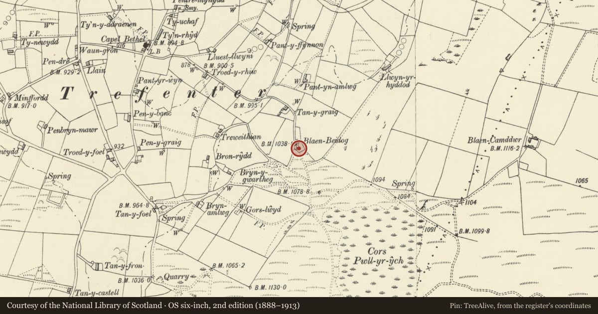
Slide toward Today to fade the historical sheet and see the modern map underneath.
David Rumsey Map Collection, Stanford LibrariesDavid Rumsey Map Collection, Stanford LibrariesDavid Rumsey Map Collection, Stanford LibrariesDavid Rumsey Map Collection, Stanford LibrariesDavid Rumsey Map Collection, Stanford Libraries
5 historical maps cover this location, the earliest the 1830 map "V.3:11-15:XV. Britisches Reich. A. Kon: England. b. Frstenthum Wales: Shire: 37-40" (David Rumsey Map Collection, Stanford Libraries).
Historical maps covering this location
- 1830 · V.3:11-15:XV. Britisches Reich. A. Kon: England. b. Frstenthum Wales: Shire: 37-40 (David Rumsey Map Collection, Stanford Libraries)
- 1896 · Sheet 7. Ordnance Survey of England and Wales. (David Rumsey Map Collection, Stanford Libraries)
- 1899 · 178 Llanilar (Hills) (David Rumsey Map Collection, Stanford Libraries)
- 1901 · Sheet 14. (David Rumsey Map Collection, Stanford Libraries)
- 1919 · Sheet 78. Lampeter. (David Rumsey Map Collection, Stanford Libraries)
Cadw's description
Location
Situated on the E side of a metalled track to the SE of the village centre.
History
Small C19 house of two-room plan with entry through a rear outshut. Marked on 1842 Tithe Map, but possibly rebuilt later. In 1842 the owner/occupier of the cottage and garden was one Anne Evans, who shared the house with Richard Morgan.
Exterior
House, rubble stone with close-eaved slate roof and stone end stacks, larger to right. Two-storey, 2-window front to garden with 4-pane sashes, smaller above, stone voussoirs to ground floor, slab lintels to upper floor and thick stone sills. Windowless end walls. Rear outshut has door in end wall, with access to main house from within outshut.
Interior
Not inspected.
Reason for designation
Included as small traditional house of unusual plan, possibly a replacement for a cottage encroaching on marginal land.
Nearby in the register
- Cottage some 250m ESE of Pentre MynyddDomesticunder 1 mi
- Ty CapelReligious, Ritual and Funeraryunder 1 mi
- Capel Bethel including vestry to leftReligious, Ritual and Funeraryunder 1 mi
- Pentre MynyddDomesticunder 1 mi
Other entries of the same register within about three miles of this one, by straight line.