Cof Cymru: National Historic Assets of Wales · Wales
Beaumaris Lodge
Pentraeth, Isle of Anglesey, Wales
A Grade II listed building in Plas Gwyn Estate, Pentraeth, Isle of Anglesey, designated on 14 January 2003.
The record
- Designation
- Listed building, Grade II
- Broad class
- Domestic
- Date of designation
- 14 January 2003
- Locality
- Plas Gwyn Estate
- Community
- Pentraeth
- Unitary authority
- Isle of Anglesey
- Country
- Wales
- Coordinates
- 53.28071, -4.19950
- Cadw reference
- 80821
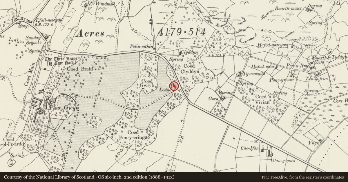
Slide toward Today to fade the historical sheet and see the modern map underneath.
David Rumsey Map Collection, Stanford LibrariesDavid Rumsey Map Collection, Stanford LibrariesDavid Rumsey Map Collection, Stanford LibrariesDavid Rumsey Map Collection, Stanford LibrariesDavid Rumsey Map Collection, Stanford Libraries
5 historical maps cover this location, the earliest the 1883 map "Watershed map England, Wales 3." (David Rumsey Map Collection, Stanford Libraries).
Historical maps covering this location
- 1883 · Watershed map England, Wales 3. (David Rumsey Map Collection, Stanford Libraries)
- 1896 · Sheet 7. Ordnance Survey of England and Wales. (David Rumsey Map Collection, Stanford Libraries)
- 1899 · 94 Beaumaris (Hills) (David Rumsey Map Collection, Stanford Libraries)
- 1901 · Sheet 9 and 10. (David Rumsey Map Collection, Stanford Libraries)
- 1919 · Sheet 41. Anglesey. (David Rumsey Map Collection, Stanford Libraries)
Cadw's description
Location
Set back from the W side of the B5109 on its E approach to Pentraeth.
History
Mid C19 lodge, built when the E drive to Plas Gwyn was re-routed in 1840s; extended by the addition of a flat roofed block to rear in C20.
Exterior
Single storey lodge, built to an L-shaped plan with modern flat roofed addition to N and W. Roughcast rendered elevations with smooth rendered plinth course. Roof of large slates with 2 shallow courses at ridge. Shaped and moulded Dutch parapet gables. Paired diagonally set shafts are set on a rectangular stack to rear, directly behind the entrance. The principal elevation faces the road to E and has a boarded door in a chamfered entrance within an advanced central porch with chamfered angles and a similar shaped gable; a blank recess is set in the gable over the doorway. Casement windows have timber mullions; the S wall has a canted bay window with slate roof.
Interior
Interior not inspected at the time of the survey.
Reason for designation
Included as a good early C19 lodge which, together with the adjacent walls, gates and railings, is an integral part of the Plas Gwyn Estate.
Nearby in the register
- Gates and walled railings at Beaumaris LodgeGardens, Parks and Urban Spacesunder 1 mi
- Icehouse at Plas GwynDomesticunder 1 mi
- Plas GwynDomesticunder 1 mi
- Former Laundry and Servant's Hall at Plas GwynNo class recordedunder 1 mi
Other entries of the same register within about three miles of this one, by straight line.