Cof Cymru: National Historic Assets of Wales · Wales
Barn at Plas Gwyn
Pentraeth, Isle of Anglesey, Wales
A Grade II listed building in Plas Gwyn Estate, Pentraeth, Isle of Anglesey, designated on 14 January 2003.
The record
- Designation
- Listed building, Grade II
- Broad class
- Agriculture and Subsistence
- Date of designation
- 14 January 2003
- Locality
- Plas Gwyn Estate
- Community
- Pentraeth
- Unitary authority
- Isle of Anglesey
- Country
- Wales
- Coordinates
- 53.27967, -4.20918
- Cadw reference
- 80820
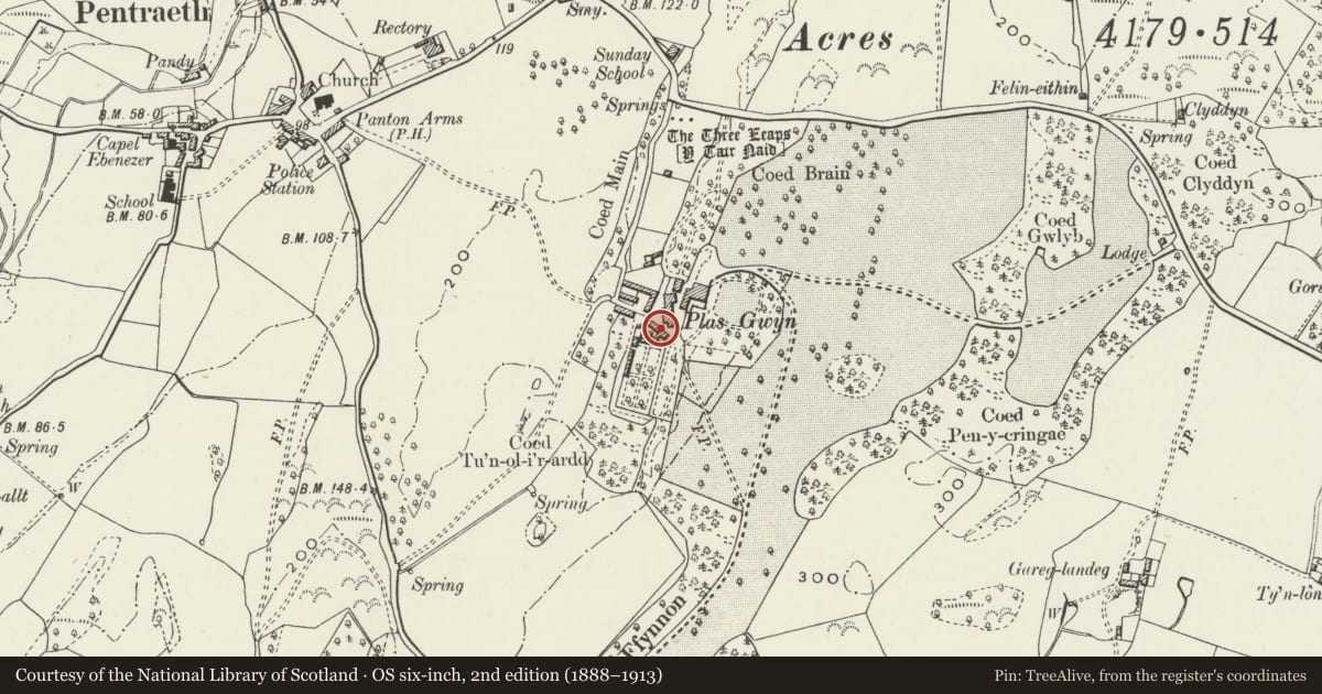
Slide toward Today to fade the historical sheet and see the modern map underneath.
David Rumsey Map Collection, Stanford LibrariesDavid Rumsey Map Collection, Stanford LibrariesDavid Rumsey Map Collection, Stanford LibrariesDavid Rumsey Map Collection, Stanford LibrariesDavid Rumsey Map Collection, Stanford Libraries
5 historical maps cover this location, the earliest the 1883 map "Watershed map England, Wales 3." (David Rumsey Map Collection, Stanford Libraries).
Historical maps covering this location
- 1883 · Watershed map England, Wales 3. (David Rumsey Map Collection, Stanford Libraries)
- 1896 · Sheet 7. Ordnance Survey of England and Wales. (David Rumsey Map Collection, Stanford Libraries)
- 1899 · 94 Beaumaris (Hills) (David Rumsey Map Collection, Stanford Libraries)
- 1901 · Sheet 9 and 10. (David Rumsey Map Collection, Stanford Libraries)
- 1919 · Sheet 41. Anglesey. (David Rumsey Map Collection, Stanford Libraries)
Cadw's description
Location
Set back, within private grounds, between the A5025 and the B5109 SW of Pentraeth. The barn lies to SW of the house at Plas Gwyn, directly to SW of the cottage range.
History
Early C18 threshing barn. There is a beam which is carved with the initials and date: W E J (for William Jones) / 1732.
Exterior
Threshing barn of 7 bays, each bay articulated by ground and loft ventilation slits. Built of rubble masonry, the central wide opposing doorways have dressed stone voussoir heads; smaller doorway to R. Roof of slates laid to diminishing courses with stone ridge. To the R of the main threshing door there is a weighbridge formed of a rectangular metal plate on the ground; a small 4-paned light has been cut to allow viewing of weighing scales housed inside. The narrow doorway to R is also a later cut. The gable elevations are also pierced by ventilation slits; 3 to ground and 1st floors, with 2 in the gable apex. The rear threshing door has been partially infilled with brick and now houses a 16-pane sash window.
Interior
Rough hewn beams and collared trusses; massive cross beams at 1st floor level show evidence of joists to a former loft floor. One beam bears the carved initials and date: W E J / 1732. The wide threshing doors have large tulip headed hinges.
Reason for designation
Included as a fine early C18 threshing barn which retains a strong vernacular character. The barn predates some of the more formal estate buildings but is of a scale that represents the wealth of the estate in the early C18 and is an integral part of the ancillary buildings that are grouped around the estate centre at Plas Gwyn.
Nearby in the register
- Gardener's cottage and walled garden at Plas GwynGardens, Parks and Urban Spacesunder 1 mi
- Lofted stables, cottage, kennel and coachhouse range at Plas GwynDomesticunder 1 mi
- Cartshed at Plas GwynAgriculture and Subsistenceunder 1 mi
- Former Laundry and Servant's Hall at Plas GwynNo class recordedunder 1 mi
Other entries of the same register within about three miles of this one, by straight line.