Cof Cymru: National Historic Assets of Wales · Wales
Presbytery to the Catholic Church of St Michael, including boundary wall
Brecon, Powys, Wales
A Grade II listed building in Brecon, Powys, designated on 16 December 1976.
The record
- Designation
- Listed building, Grade II
- Broad class
- Religious, Ritual and Funerary
- Date of designation
- 16 December 1976
- Date of amendment
- 30 May 2024
- Welsh name
- Tŷ’r offeiriad Eglwys Gatholig Sant Mihangel, gan gynnwys mur terfyn
- Town
- Brecon
- Community
- Brecon
- Unitary authority
- Powys
- Country
- Wales
- Coordinates
- 51.94710, -3.39250
- Cadw reference
- 7021
Slide toward Today to fade the historical sheet and see the modern map underneath.
David Rumsey Map Collection, Stanford LibrariesDavid Rumsey Map Collection, Stanford LibrariesDavid Rumsey Map Collection, Stanford LibrariesDavid Rumsey Map Collection, Stanford LibrariesDavid Rumsey Map Collection, Stanford Libraries
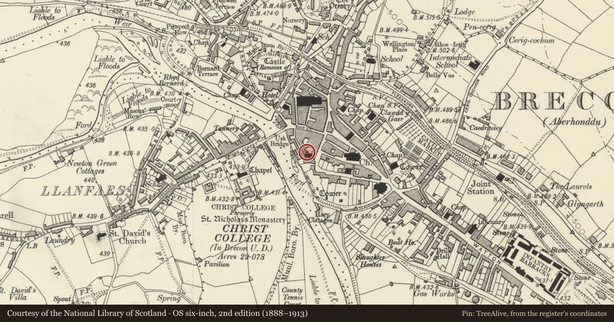
5 historical maps cover this location, the earliest the 1608 map "(13) Cambriae Typus." (David Rumsey Map Collection, Stanford Libraries).
Historical maps covering this location
- 1608 · (13) Cambriae Typus. (David Rumsey Map Collection, Stanford Libraries)
- 1636 · Cornubia : Devonia, Somersetus, Dorcestria, Wiltonia, Glocestria ... (David Rumsey Map Collection, Stanford Libraries)
- 1856 · 42. Brecon. (David Rumsey Map Collection, Stanford Libraries)
- 1898 · 213 Brecon (Hills) (David Rumsey Map Collection, Stanford Libraries)
- 1901 · Sheet 14. (David Rumsey Map Collection, Stanford Libraries)
Cadw's description
Location
Attached to rear of St Michael's Church.
History
1851 by Charles Hansom but with C20 alterations.
Exterior
Presbytery. Stone walls. Slate roofs. To the NW, a gabled wing projects forward at right-angles to the church; the gable itself is slate-hung and lit by a casement window; on ground floor a modern window. Blank NW return wall of this wing. A further narrower wing to the L at right angles on a NW to SE axis; slate hung upper floor, modern glazing. Enclosed by a high boundary wall of stone rubble with hues of purple and grey with ashlar coping; a flight of steps leads up through this to a two-centred headed doorway in the wing of the Presbytery adjoining the Chancel.
Interior
Not inspected.
Reason for designation
Included for its special architectural interest as a well preserved Presbytery designed by a leading architect. Group Value with Church of St Michael, and for contribution of its wall to the streetscape.
Nearby in the register
- Catholic Church of St MichaelReligious, Ritual and Funeraryunder 1 mi
- Front Wing of St Michael's HallReligious, Ritual and Funeraryunder 1 mi
- 10 Wheat StreetDomesticunder 1 mi
- 9 Wheat StreetNo class recordedunder 1 mi
Other entries of the same register within about three miles of this one, by straight line.