Cof Cymru: National Historic Assets of Wales · Wales
Front Wing of St Michael's Hall
Brecon, Powys, Wales
A Grade II listed building in Brecon, Powys, designated on 16 December 1976.
The record
- Designation
- Listed building, Grade II
- Broad class
- Religious, Ritual and Funerary
- Date of designation
- 16 December 1976
- Date of amendment
- 30 May 2024
- Welsh name
- Neuadd Sant Mihangel (adain flaen)
- Town
- Brecon
- Community
- Brecon
- Unitary authority
- Powys
- Country
- Wales
- Coordinates
- 51.94707, -3.39212
- Cadw reference
- 7148
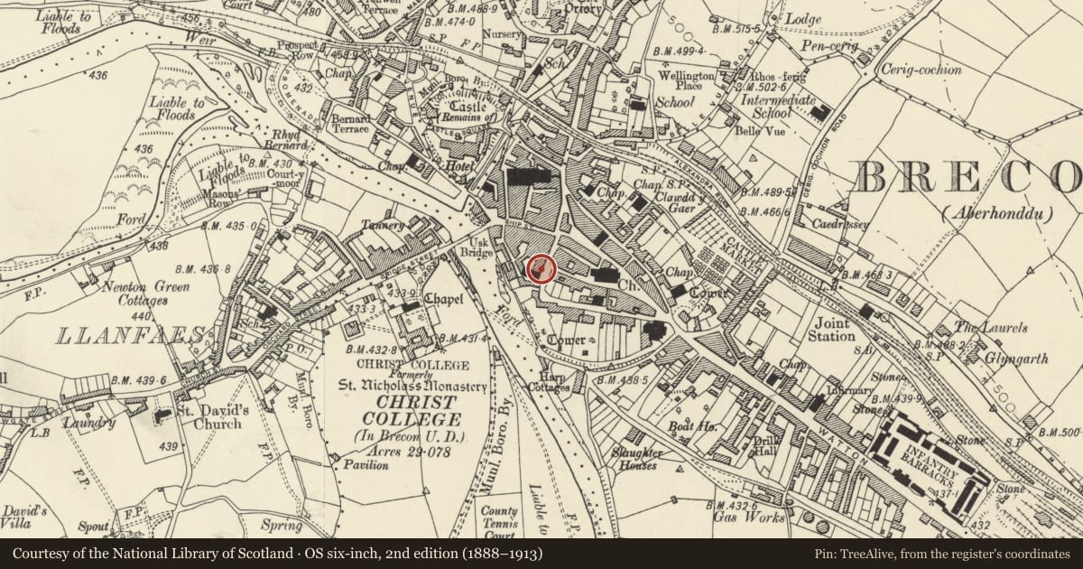
Slide toward Today to fade the historical sheet and see the modern map underneath.
David Rumsey Map Collection, Stanford LibrariesDavid Rumsey Map Collection, Stanford LibrariesDavid Rumsey Map Collection, Stanford LibrariesDavid Rumsey Map Collection, Stanford LibrariesDavid Rumsey Map Collection, Stanford Libraries
5 historical maps cover this location, the earliest the 1608 map "(13) Cambriae Typus." (David Rumsey Map Collection, Stanford Libraries).
Historical maps covering this location
- 1608 · (13) Cambriae Typus. (David Rumsey Map Collection, Stanford Libraries)
- 1636 · Cornubia : Devonia, Somersetus, Dorcestria, Wiltonia, Glocestria ... (David Rumsey Map Collection, Stanford Libraries)
- 1856 · 42. Brecon. (David Rumsey Map Collection, Stanford Libraries)
- 1898 · 213 Brecon (Hills) (David Rumsey Map Collection, Stanford Libraries)
- 1901 · Sheet 14. (David Rumsey Map Collection, Stanford Libraries)
Cadw's description
Location
Immediately to right of St Michael's Church.
History
Early C19. Probably constructed as a townhouse and later converted 1919 as the Electrotheatre Cinema with seating for 400. Cinema use finished 1925. Later converted to use as a parish hall.
Exterior
Stuccoed facade to Wheat Street of 2 storeys, 3 windows. Slate roof. On first floor, three sash windows with marginal glazing bars and horns. Two tripartite sash windows on ground floor each flanking central doorway with fluted pilasters and cornice on console brackets; rectangular fanlight; four-panelled door. Return wall of stone.
Interior
Ffasâd gwaith stwco i 2 lawr Stryd Wheat, 3 ffenestr. To llechi. Ar y llawr cyntaf, tair ffenestr-godi gyda bariau gwydro ymylol a chyrn. Dwy ffenestr-godi deiran ar y llawr gwaelod, y ddwy yn ystlysu drws canolog gyda philastrau rhychiog a chornis ar fracedi consol; ffenestr linter hirsgwar; drws bedwar-panel. Y wal wrthdro o gerrig.
Reason for designation
Included for its special architectural interest as a well preserved early C19 townhouse, later converted. Group value with St Michael's Church and adjacent listed buildings.
Nearby in the register
- 10 Wheat StreetDomesticunder 1 mi
- Catholic Church of St MichaelReligious, Ritual and Funeraryunder 1 mi
- 9 Wheat StreetNo class recordedunder 1 mi
- Ruperra House, including pavement cobbles to front.Domesticunder 1 mi
Other entries of the same register within about three miles of this one, by straight line.