Cof Cymru: National Historic Assets of Wales · Wales
5 St Mary Street
Brecon, Powys, Wales
A Grade II* listed building in Brecon, Powys, designated on 16 January 1952.
The record
- Designation
- Listed building, Grade II*
- Broad class
- Domestic
- Date of designation
- 16 January 1952
- Town
- Brecon
- Community
- Brecon
- Unitary authority
- Powys
- Country
- Wales
- Coordinates
- 51.94676, -3.39063
- Cadw reference
- 7019
Slide toward Today to fade the historical sheet and see the modern map underneath.
David Rumsey Map Collection, Stanford LibrariesDavid Rumsey Map Collection, Stanford LibrariesDavid Rumsey Map Collection, Stanford LibrariesDavid Rumsey Map Collection, Stanford LibrariesDavid Rumsey Map Collection, Stanford Libraries
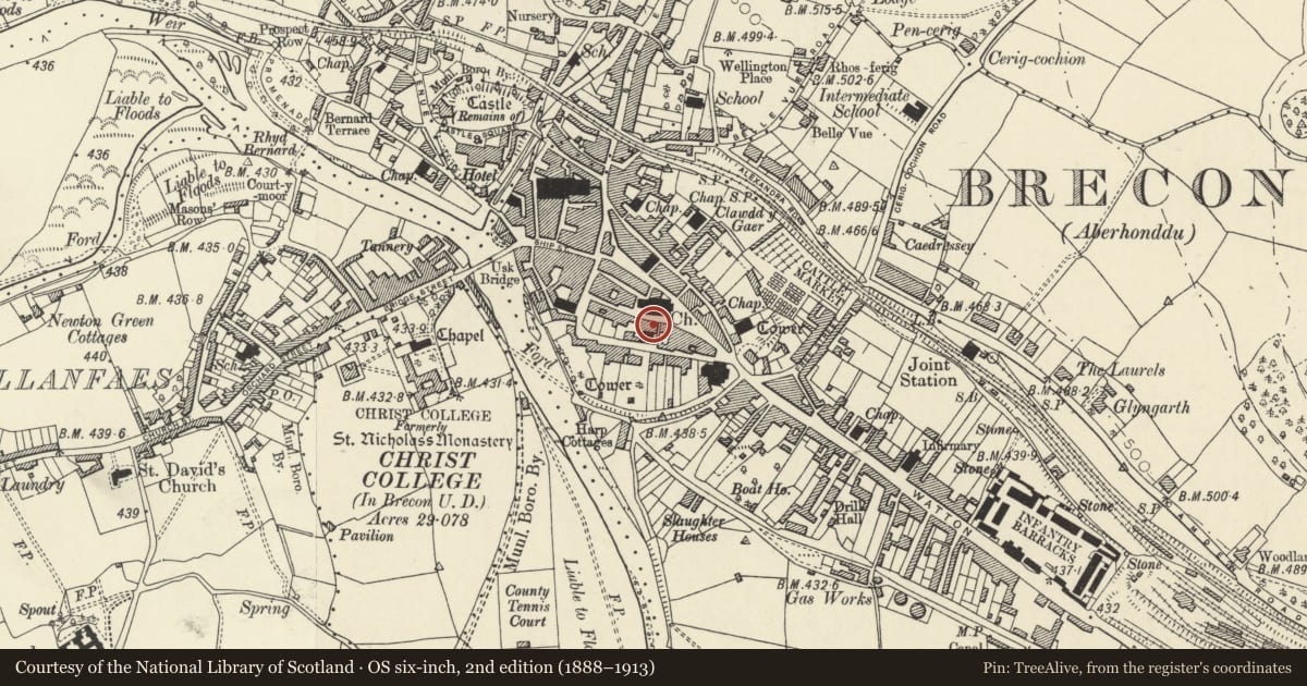
5 historical maps cover this location, the earliest the 1608 map "(13) Cambriae Typus." (David Rumsey Map Collection, Stanford Libraries).
Historical maps covering this location
- 1608 · (13) Cambriae Typus. (David Rumsey Map Collection, Stanford Libraries)
- 1636 · Cornubia : Devonia, Somersetus, Dorcestria, Wiltonia, Glocestria ... (David Rumsey Map Collection, Stanford Libraries)
- 1856 · 42. Brecon. (David Rumsey Map Collection, Stanford Libraries)
- 1898 · 213 Brecon (Hills) (David Rumsey Map Collection, Stanford Libraries)
- 1901 · Sheet 14. (David Rumsey Map Collection, Stanford Libraries)
Cadw's description
Location
Immediately to S of St Mary's Church, on corner with lane to Glamorgan Street.
History
Late C18; thought to have been built by William Wynter (1765-1805) as his town house. The design approximates very closely to a widespread English design (see references). Used circa 1830 as first Independent Congregational College.
Exterior
Former house, now club. Rendered; roughcast front to St Mary Street front of 4 storeys, 5 windows; but ground floor rendered. Slate hipped roof with red tile ridges. Modillion eaves cornice. Band at first floor level. Small-pane sash windows in moulded architraves; Venetian window in central bay on first floor. In central bay on ground floor, a good moulded wooden doorcase with pediment, Doric pilasters, cornice and fanlight with tracery, flanked to each side by a Venetian window with interlaced arched glazing bars.
Interior
Converted to club use with suspended ceilings etc; said to retain contemporary mouldings and cornices etc. To rear of bar, extremely good late C18 wooden stair, turned balusters, panelled dado.
Reason for designation
Graded II* as fine C18 town house retaining much of its character. Group value.
Nearby in the register
- 4 St Mary StreetDomesticunder 1 mi
- The Old MuseumReligious, Ritual and Funeraryunder 1 mi
- Barclay's BankCommercialunder 1 mi
- Pair of Telephone Call-boxes outside former yard of Old Post OfficeCommunicationsunder 1 mi
Other entries of the same register within about three miles of this one, by straight line.