Cof Cymru: National Historic Assets of Wales · Wales
The Old Museum
Brecon, Powys, Wales
A Grade II listed building in Brecon, Powys, designated on 16 January 1952.
The record
- Designation
- Listed building, Grade II
- Broad class
- Religious, Ritual and Funerary
- Date of designation
- 16 January 1952
- Town
- Brecon
- Community
- Brecon
- Unitary authority
- Powys
- Country
- Wales
- Coordinates
- 51.94661, -3.39071
- Cadw reference
- 6892
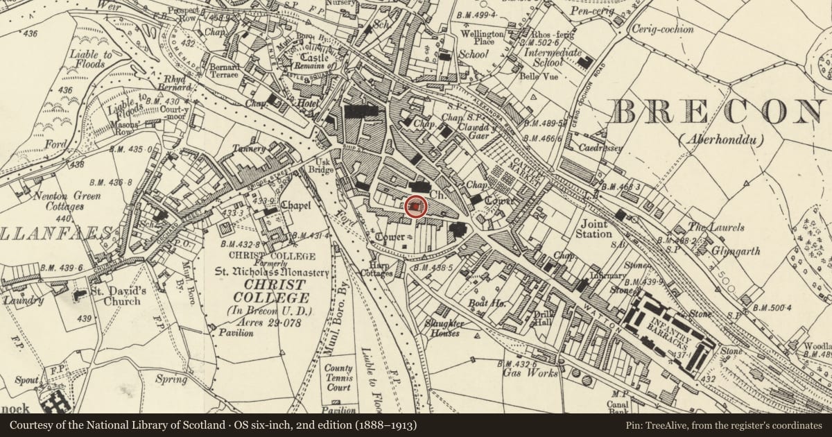
Slide toward Today to fade the historical sheet and see the modern map underneath.
David Rumsey Map Collection, Stanford LibrariesDavid Rumsey Map Collection, Stanford LibrariesDavid Rumsey Map Collection, Stanford LibrariesDavid Rumsey Map Collection, Stanford LibrariesDavid Rumsey Map Collection, Stanford Libraries
5 historical maps cover this location, the earliest the 1608 map "(13) Cambriae Typus." (David Rumsey Map Collection, Stanford Libraries).
Historical maps covering this location
- 1608 · (13) Cambriae Typus. (David Rumsey Map Collection, Stanford Libraries)
- 1636 · Cornubia : Devonia, Somersetus, Dorcestria, Wiltonia, Glocestria ... (David Rumsey Map Collection, Stanford Libraries)
- 1856 · 42. Brecon. (David Rumsey Map Collection, Stanford Libraries)
- 1898 · 213 Brecon (Hills) (David Rumsey Map Collection, Stanford Libraries)
- 1901 · Sheet 14. (David Rumsey Map Collection, Stanford Libraries)
Cadw's description
Location
Opposite Morgannwg House.
History
Opened 1836. Built by David Blow, English Independent Congregationalist Minister. This was the main building of the Brecknock Museum from 1927 until 1974.
Exterior
Former Chapel. Stone, faced in cement rendering. Two storeys. Two blocks of three and two windows. Taller 3-window block has slate roof with paired bracketed eaves. Band and pilasters at first floor level; ground floor rusticated.. First floor windows with moulded archivolts; round-headed sash windows with interlacing tracery. Steps up to plain round-headed doorway in centre with panelled doors and fanlight; windows as those above. Right hand return wall is curved at north east end; exposed stone with brick dressings to windows as front. Slightly lower wing at west end of 3 storeys, 2 windows with floors at different levels to main block. Round-headed windows with interlacing tracery. Parapet with plain capping.
Reason for designation
Earlier C19 chapel retaining its exterior character and with Group Value with adjacent listed buildings.
Nearby in the register
- 5 St Mary StreetDomesticunder 1 mi
- 4 St Mary StreetDomesticunder 1 mi
- Barclay's BankCommercialunder 1 mi
- 3 Glamorgan StreetDomesticunder 1 mi
Other entries of the same register within about three miles of this one, by straight line.