Cof Cymru: National Historic Assets of Wales · Wales
The Emporium
Narberth, Pembrokeshire, Wales
A Grade II listed building in Narberth, Pembrokeshire, designated on 17 May 1988.
The record
- Designation
- Listed building, Grade II
- Broad class
- Commercial
- Date of designation
- 17 May 1988
- Community
- Narberth
- Unitary authority
- Pembrokeshire
- Country
- Wales
- Coordinates
- 51.79990, -4.74398
- Cadw reference
- 6501
Slide toward Today to fade the historical sheet and see the modern map underneath.
David Rumsey Map Collection, Stanford LibrariesDavid Rumsey Map Collection, Stanford LibrariesDavid Rumsey Map Collection, Stanford LibrariesDavid Rumsey Map Collection, Stanford LibrariesDavid Rumsey Map Collection, Stanford Libraries
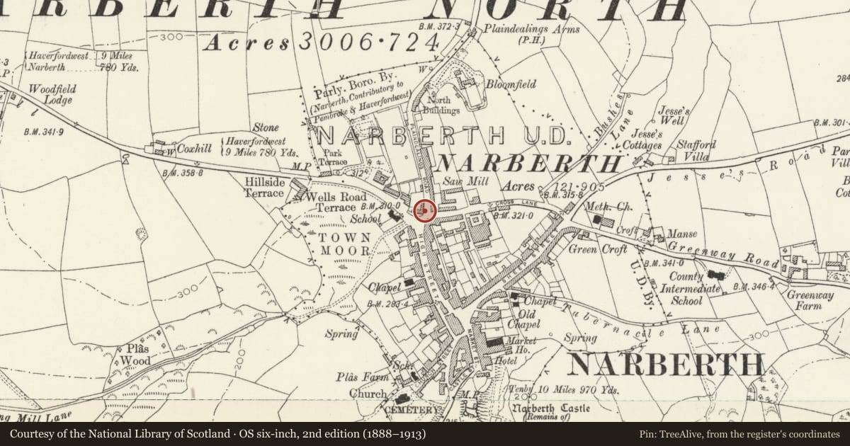
5 historical maps cover this location, the earliest the 1636 map "Cornubia : Devonia, Somersetus, Dorcestria, Wiltonia, Glocestria ..." (David Rumsey Map Collection, Stanford Libraries).
Historical maps covering this location
- 1636 · Cornubia : Devonia, Somersetus, Dorcestria, Wiltonia, Glocestria ... (David Rumsey Map Collection, Stanford Libraries)
- 1830 · V.3:11-15:XV. Britisches Reich. A. Kon: England. b. Frstenthum Wales: Shire: 37-40 (David Rumsey Map Collection, Stanford Libraries)
- 1891 · Sheet 10. Ordnance Survey of England and Wales. . (David Rumsey Map Collection, Stanford Libraries)
- 1898 · 228 Haverfordwest (Hills) (David Rumsey Map Collection, Stanford Libraries)
- 1901 · Sheet 13. (David Rumsey Map Collection, Stanford Libraries)
Cadw's description
Location
Adjoining Hill House and stepped down to the right at the junction with Northfield Road.
Exterior
C19, 2 storey shop, colourwashed roughcast on rubble. Steeply pitched slate roof, continuous outshot to rear. Plain eaves. Truncated brick stack to right, tall brick stack to outshot..
Victorian sash window to 1st floor. C10 shop window to ground floor, 10 pane transomed window. Reeded pilasters, rectangular fascia ends on consoles.
Modern doorway to left below large rectangular nameboard (gives access also to adjoining Hill House).
Good C19 iron railings to forecourt, contemporary gateway to right.
2 window elevation to Northfield road. Victorian oriel window to 1st floor right.
Tripartite on moulded bracket with dentil cornice. Sash window to left. Similar to ground floor. Plain reveals, slate sills.
Reason for designation
Group value with Hill House and Coach Horses Inn on opposite corner.
Nearby in the register
- Hill House (Chestnut Tree Lodge)Commercialunder 1 mi
- The Coach & Horses InnCommercialunder 1 mi
- 2 High StreetDomesticunder 1 mi
- Animal KitchenCommercialunder 1 mi
Other entries of the same register within about three miles of this one, by straight line.