Cof Cymru: National Historic Assets of Wales · Wales
Hill House (Chestnut Tree Lodge)
Narberth, Pembrokeshire, Wales
A Grade II listed building in Narberth, Pembrokeshire, designated on 17 May 1988.
The record
- Designation
- Listed building, Grade II
- Broad class
- Commercial
- Date of designation
- 17 May 1988
- Community
- Narberth
- Unitary authority
- Pembrokeshire
- Country
- Wales
- Coordinates
- 51.79993, -4.74414
- Cadw reference
- 6500
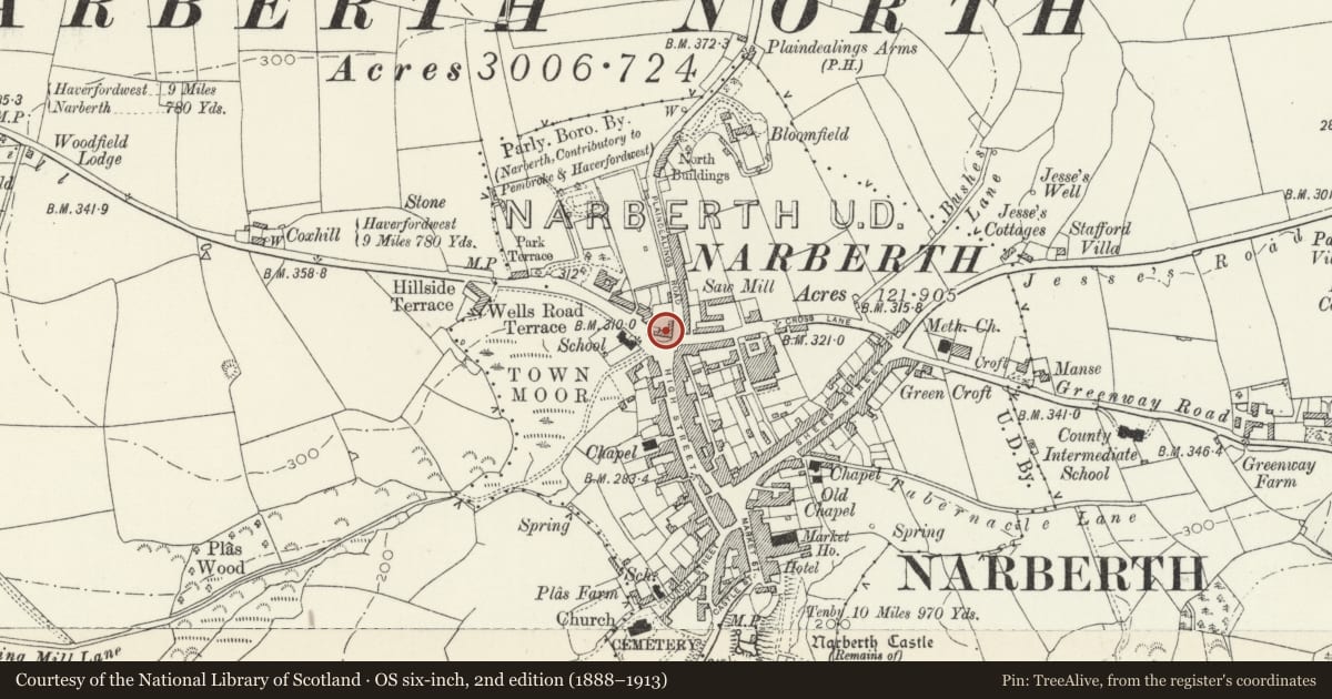
Slide toward Today to fade the historical sheet and see the modern map underneath.
David Rumsey Map Collection, Stanford LibrariesDavid Rumsey Map Collection, Stanford LibrariesDavid Rumsey Map Collection, Stanford LibrariesDavid Rumsey Map Collection, Stanford LibrariesDavid Rumsey Map Collection, Stanford Libraries
5 historical maps cover this location, the earliest the 1636 map "Cornubia : Devonia, Somersetus, Dorcestria, Wiltonia, Glocestria ..." (David Rumsey Map Collection, Stanford Libraries).
Historical maps covering this location
- 1636 · Cornubia : Devonia, Somersetus, Dorcestria, Wiltonia, Glocestria ... (David Rumsey Map Collection, Stanford Libraries)
- 1830 · V.3:11-15:XV. Britisches Reich. A. Kon: England. b. Frstenthum Wales: Shire: 37-40 (David Rumsey Map Collection, Stanford Libraries)
- 1891 · Sheet 10. Ordnance Survey of England and Wales. . (David Rumsey Map Collection, Stanford Libraries)
- 1898 · 228 Haverfordwest (Hills) (David Rumsey Map Collection, Stanford Libraries)
- 1901 · Sheet 13. (David Rumsey Map Collection, Stanford Libraries)
Cadw's description
Location
Prominently sited at the N end of the Higher Street at the confluence of Spring Gardens, Moorfield and Northfield Roads.
Exterior
Late C18, 3 storey 3 window house with later continuous lateral outshot to rear. Colour washed plaster on rubble. Steeply pitched slate roof, plain eaves.
Rendered stacks, water tabling. Slate hung gable ends.
Victorian sashes to shallow 2nd floor windows, continuous sill band. Modern 6 light shop windows to ground floor, over-large nameboards.
Partly modernised C19 gabled portico to former central doorway. Cast iron columns; half columns flank former entrance. Doorway blocked to form window.
(Access at time of inspection via Emporium adjoining to right).
Modern brick steps to forecourt flanked by C19 colourwashed forecourt wall bearing good C19 ironwork railings.
Sash windows to lofted outshot at rear; 6 small panes over 2 long panes.
Reason for designation
Group value with other listed items at N end of the High Street.
Nearby in the register
- The EmporiumCommercialunder 1 mi
- The Coach & Horses InnCommercialunder 1 mi
- 2 High StreetDomesticunder 1 mi
- Animal KitchenCommercialunder 1 mi
Other entries of the same register within about three miles of this one, by straight line.