Cof Cymru: National Historic Assets of Wales · Wales
2 High Street
Narberth, Pembrokeshire, Wales
A Grade II listed building in Narberth, Pembrokeshire, designated on 17 May 1988.
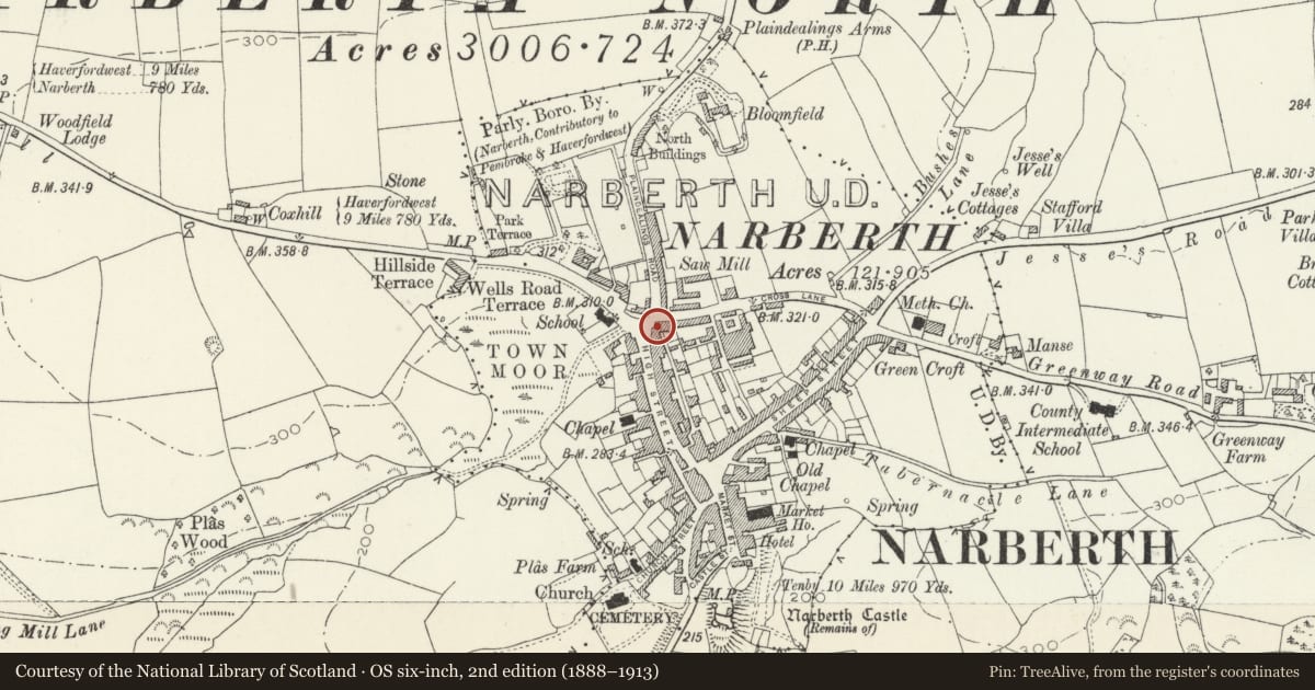
The record
- Designation
- Listed building, Grade II
- Broad class
- Domestic
- Date of designation
- 17 May 1988
- Community
- Narberth
- Unitary authority
- Pembrokeshire
- Country
- Wales
- Coordinates
- 51.79970, -4.74386
- Cadw reference
- 6478
Slide toward Today to fade the historical sheet and see the modern map underneath.
David Rumsey Map Collection, Stanford LibrariesDavid Rumsey Map Collection, Stanford LibrariesDavid Rumsey Map Collection, Stanford LibrariesDavid Rumsey Map Collection, Stanford LibrariesDavid Rumsey Map Collection, Stanford Libraries
5 historical maps cover this location, the earliest the 1636 map "Cornubia : Devonia, Somersetus, Dorcestria, Wiltonia, Glocestria ..." (David Rumsey Map Collection, Stanford Libraries).
Historical maps covering this location
- 1636 · Cornubia : Devonia, Somersetus, Dorcestria, Wiltonia, Glocestria ... (David Rumsey Map Collection, Stanford Libraries)
- 1830 · V.3:11-15:XV. Britisches Reich. A. Kon: England. b. Frstenthum Wales: Shire: 37-40 (David Rumsey Map Collection, Stanford Libraries)
- 1891 · Sheet 10. Ordnance Survey of England and Wales. . (David Rumsey Map Collection, Stanford Libraries)
- 1898 · 228 Haverfordwest (Hills) (David Rumsey Map Collection, Stanford Libraries)
- 1901 · Sheet 13. (David Rumsey Map Collection, Stanford Libraries)
Cadw's description
Location
On the street line adjoining the Coach and Horses Inn on the corner with Spring Gardens.
Exterior
Early-mid C19, 2 storey, 1 window house. Coursed rubble masonry. Moderately pitched slate roof, plain eaves. Rendered brick stack.
Victorian sash window to 1st floor, similar to ground floor. Stone voussoirs, cement architraves, painted sills.
Doorway offset to left. Steps recessed within wall up to 4 panel C19 door, upper panels glazed.
Reason for designation
Good example of simple urban vernacular.
Group value with buildings adjoining.
Nearby in the register
- 3 High StreetCommercialunder 1 mi
- The Coach & Horses InnCommercialunder 1 mi
- Animal KitchenCommercialunder 1 mi
- The EmporiumCommercialunder 1 mi
Other entries of the same register within about three miles of this one, by straight line.