Cof Cymru: National Historic Assets of Wales · Wales
8 Upper Frog Street
Tenby, Pembrokeshire, Wales
A Grade II listed building in Tenby, Pembrokeshire, designated on 26 April 1977.
The record
- Designation
- Listed building, Grade II
- Broad class
- Commercial
- Date of designation
- 26 April 1977
- Town
- Tenby
- Community
- Tenby
- Unitary authority
- Pembrokeshire
- Country
- Wales
- Coordinates
- 51.67162, -4.70069
- Cadw reference
- 6298
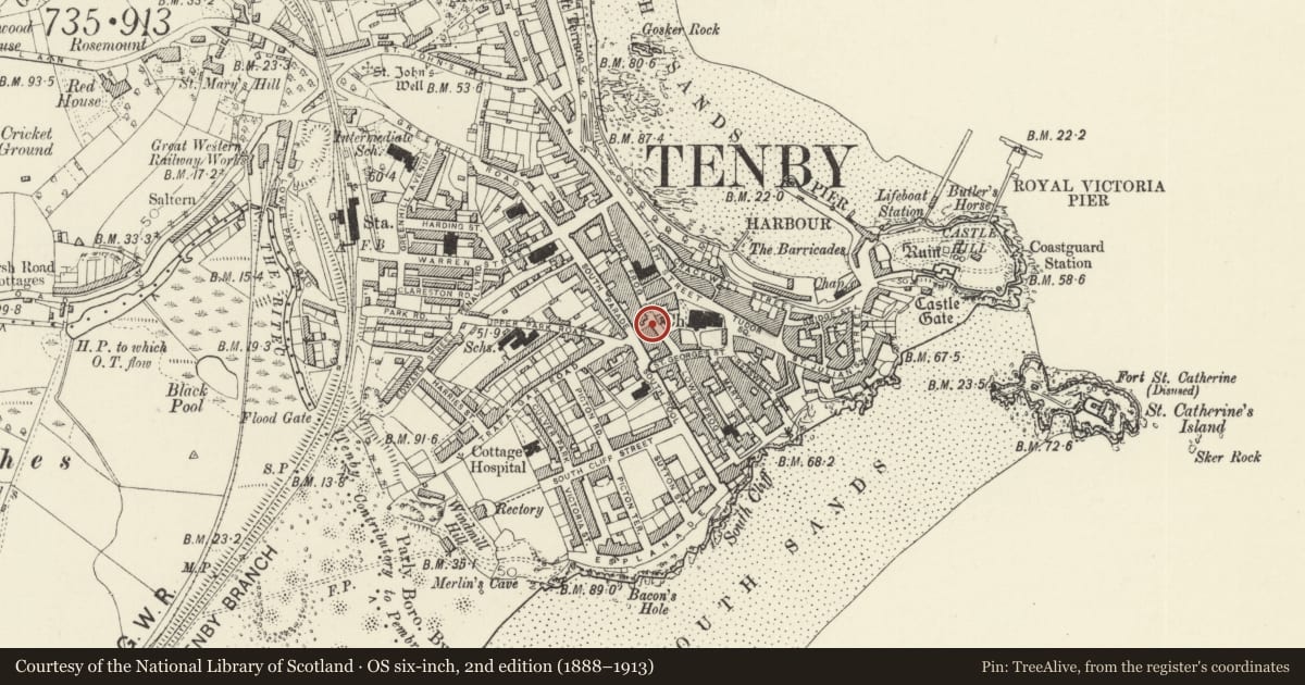
Slide toward Today to fade the historical sheet and see the modern map underneath.
David Rumsey Map Collection, Stanford LibrariesDavid Rumsey Map Collection, Stanford LibrariesDavid Rumsey Map Collection, Stanford LibrariesDavid Rumsey Map Collection, Stanford LibrariesDavid Rumsey Map Collection, Stanford Libraries
5 historical maps cover this location, the earliest the 1636 map "Cornubia : Devonia, Somersetus, Dorcestria, Wiltonia, Glocestria ..." (David Rumsey Map Collection, Stanford Libraries).
Historical maps covering this location
- 1636 · Cornubia : Devonia, Somersetus, Dorcestria, Wiltonia, Glocestria ... (David Rumsey Map Collection, Stanford Libraries)
- 1865 · England and Wales. England No. 6. (David Rumsey Map Collection, Stanford Libraries)
- 1891 · Sheet 10. Ordnance Survey of England and Wales. . (David Rumsey Map Collection, Stanford Libraries)
- 1898 · 245 Pembroke (Hills) (David Rumsey Map Collection, Stanford Libraries)
- 1901 · Sheet 13. (David Rumsey Map Collection, Stanford Libraries)
Cadw's description
Location
On the W side of Upper Frog Street some 55m N of the junction with St George's Street.
History
Mid to later C19 detached house with ground floor shop. Occupied by W J Thomas gift shop in 1977 and 2001.
Exterior
House with shop, painted stucco narrow front of 3 storeys, 1 bay, with slate hipped close-eaved roof. Quoins, 2nd floor 4-pane sash window, 1st floor big canted oriel window of 2-4-2-pane horned sashes with moulded cornice. Ground floor has 3 plain pilasters, one each side of shopwindow and third to right of square-headed doorway to right. Paired brackets with gabled block over each side of stucco fascia, and timber cornice, interrupted by lower part of oriel. Windowless left wall in rubble stone. Roughcast right wall with 2 1st floor windows near to rear, one fixed 2-pane with etched lower light to left and hornless 3-pane sash to right.
Reason for designation
Included as mid to later C19 small commercial premises and house, retaining overall character.
Nearby in the register
- Premises occupied by All A PoundNo class recordedunder 1 mi
- 3 Upper Frog StreetDomesticunder 1 mi
- Premises occupied by La Cave RestaurantCommercialunder 1 mi
- Cobra HouseCommercialunder 1 mi
Other entries of the same register within about three miles of this one, by straight line.