Cof Cymru: National Historic Assets of Wales · Wales
Premises occupied by All A Pound
Tenby, Pembrokeshire, Wales
A Grade II listed building in Tenby, Pembrokeshire, designated on 28 March 2002.
The record
- Designation
- Listed building, Grade II
- Broad class
- No class recorded
- Date of designation
- 28 March 2002
- Locality
- Tenby
- Town
- Tenby
- Community
- Tenby
- Unitary authority
- Pembrokeshire
- Country
- Wales
- Coordinates
- 51.67179, -4.70086
- Cadw reference
- 26311
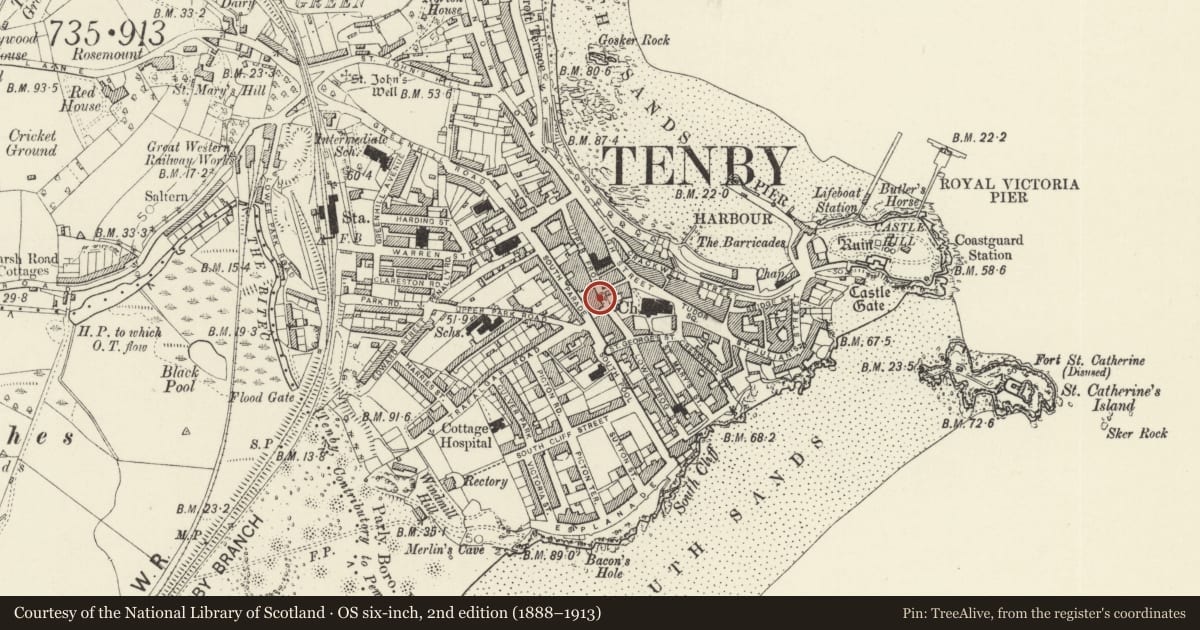
Slide toward Today to fade the historical sheet and see the modern map underneath.
David Rumsey Map Collection, Stanford LibrariesDavid Rumsey Map Collection, Stanford LibrariesDavid Rumsey Map Collection, Stanford LibrariesDavid Rumsey Map Collection, Stanford LibrariesDavid Rumsey Map Collection, Stanford Libraries
5 historical maps cover this location, the earliest the 1636 map "Cornubia : Devonia, Somersetus, Dorcestria, Wiltonia, Glocestria ..." (David Rumsey Map Collection, Stanford Libraries).
Historical maps covering this location
- 1636 · Cornubia : Devonia, Somersetus, Dorcestria, Wiltonia, Glocestria ... (David Rumsey Map Collection, Stanford Libraries)
- 1865 · England and Wales. England No. 6. (David Rumsey Map Collection, Stanford Libraries)
- 1891 · Sheet 10. Ordnance Survey of England and Wales. . (David Rumsey Map Collection, Stanford Libraries)
- 1898 · 245 Pembroke (Hills) (David Rumsey Map Collection, Stanford Libraries)
- 1901 · Sheet 13. (David Rumsey Map Collection, Stanford Libraries)
Cadw's description
Location
Situated in terraced row, a pair with the premises to right occupied by La Cave Restaurant
History
One of a pair of earlier to mid C19 houses, now with shops below.
Exterior
House and shop, left half of a single design with the premises occupied by La Cave Restaurant to right. Originally stucco lined as ashlar, unpainted C20 cladding on house to left, as original and painted on house to right, with slate roof and nogged brick eaves, covered by eaves board on house to left. End wall stacks. Three storeys, three bays with blank windows to centre bay, 4-pane horned sashes to second floor each side and first floor left, first floor right having late C19 large canted oriel of 2-4-2-pane sashes with moulded cornice. Ground floor shopfronts, with house doors paired at centre. The house to left has wholly C20 ground floor, with shop entry from recess to house door. House to right has C19 timber shopfront.
Interior
Ground floor altered.
Reason for designation
Included as part of a late Georgian style three-bay pair of houses, of group value with Cobra House.
Nearby in the register
- Premises occupied by La Cave RestaurantCommercialunder 1 mi
- Cobra HouseCommercialunder 1 mi
- 8 Upper Frog StreetCommercialunder 1 mi
- Normandie InnCommercialunder 1 mi
Other entries of the same register within about three miles of this one, by straight line.