Cof Cymru: National Historic Assets of Wales · Wales
The Hope and Anchor Public House
Tenby, Pembrokeshire, Wales
A Grade II listed building in Tenby, Pembrokeshire, designated on 26 April 1977.
The record
- Designation
- Listed building, Grade II
- Broad class
- Commercial
- Date of designation
- 26 April 1977
- Town
- Tenby
- Community
- Tenby
- Unitary authority
- Pembrokeshire
- Country
- Wales
- Coordinates
- 51.67120, -4.69671
- Cadw reference
- 6245
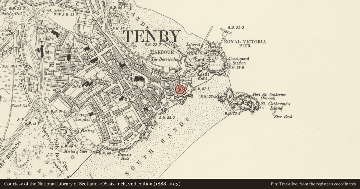
Slide toward Today to fade the historical sheet and see the modern map underneath.
David Rumsey Map Collection, Stanford LibrariesDavid Rumsey Map Collection, Stanford LibrariesDavid Rumsey Map Collection, Stanford LibrariesDavid Rumsey Map Collection, Stanford LibrariesDavid Rumsey Map Collection, Stanford Libraries
5 historical maps cover this location, the earliest the 1636 map "Cornubia : Devonia, Somersetus, Dorcestria, Wiltonia, Glocestria ..." (David Rumsey Map Collection, Stanford Libraries).
Historical maps covering this location
- 1636 · Cornubia : Devonia, Somersetus, Dorcestria, Wiltonia, Glocestria ... (David Rumsey Map Collection, Stanford Libraries)
- 1865 · England and Wales. England No. 6. (David Rumsey Map Collection, Stanford Libraries)
- 1891 · Sheet 10. Ordnance Survey of England and Wales. . (David Rumsey Map Collection, Stanford Libraries)
- 1898 · 245 Pembroke (Hills) (David Rumsey Map Collection, Stanford Libraries)
- 1901 · Sheet 13. (David Rumsey Map Collection, Stanford Libraries)
Cadw's description
Location
On the NW side of the bend in St Julian's Street opposite 5 - 7 Rock Houses.
History
Earlier C19 inn, listed in 1844 directory.
Exterior
Inn, painted roughcast with slate close-eaved roof and end stacks. Street facade of 3 storeys, double-fronted with 2 12-pane sash windows on 2nd floor, 2 first floor canted oriel windows with moulded cornices and 4-12-4-pane glazing, the centre light fixed, and ground floor C20 broad window to either side of wide cemented C20 opening with door recessed within to right. Cellar grilles each side and loading doors to right side.
Roughcast right end wall with divide down line of gable chimney, left side has 12-pane loft light, right side is stepped forward and has tiny loft light. C20 extension attached at right angles.
Interior
Ground floor altered.
Reason for designation
Included as three-storey front in late Georgian style, of group value with Lansdowne Cottages.
Nearby in the register
- No 5 Lansdowne CottagesDomesticunder 1 mi
- No 4 Lansdowne CottagesDomesticunder 1 mi
- No 3 Lansdowne CottagesDomesticunder 1 mi
- Albert ViewDomesticunder 1 mi
Other entries of the same register within about three miles of this one, by straight line.