Cof Cymru: National Historic Assets of Wales · Wales
No 3 Lansdowne Cottages
Tenby, Pembrokeshire, Wales
A Grade II listed building in Tenby, Pembrokeshire, designated on 26 April 1977.
The record
- Designation
- Listed building, Grade II
- Broad class
- Domestic
- Date of designation
- 26 April 1977
- Town
- Tenby
- Community
- Tenby
- Unitary authority
- Pembrokeshire
- Country
- Wales
- Coordinates
- 51.67112, -4.69687
- Cadw reference
- 26342
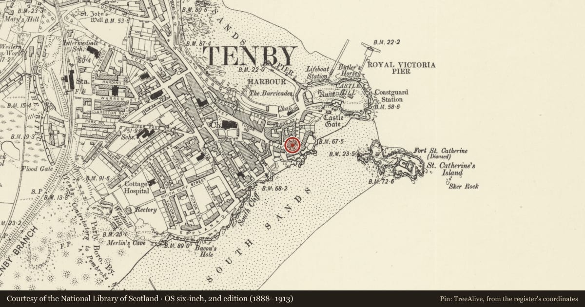
Slide toward Today to fade the historical sheet and see the modern map underneath.
David Rumsey Map Collection, Stanford LibrariesDavid Rumsey Map Collection, Stanford LibrariesDavid Rumsey Map Collection, Stanford LibrariesDavid Rumsey Map Collection, Stanford LibrariesDavid Rumsey Map Collection, Stanford Libraries
5 historical maps cover this location, the earliest the 1636 map "Cornubia : Devonia, Somersetus, Dorcestria, Wiltonia, Glocestria ..." (David Rumsey Map Collection, Stanford Libraries).
Historical maps covering this location
- 1636 · Cornubia : Devonia, Somersetus, Dorcestria, Wiltonia, Glocestria ... (David Rumsey Map Collection, Stanford Libraries)
- 1865 · England and Wales. England No. 6. (David Rumsey Map Collection, Stanford Libraries)
- 1891 · Sheet 10. Ordnance Survey of England and Wales. . (David Rumsey Map Collection, Stanford Libraries)
- 1898 · 245 Pembroke (Hills) (David Rumsey Map Collection, Stanford Libraries)
- 1901 · Sheet 13. (David Rumsey Map Collection, Stanford Libraries)
Cadw's description
Location
Third of a terrace of five on the NW side of the bend in St Julian's Street opposite 1 Rock Houses.
History
Part of an earlier to mid C19 curved terrace of 5 small 2-storey houses. Restored in late C20.
Exterior
Terrace of 5 small houses of formal design built on curve, though each house flat fronted. Two projecting features: No 2 and the combined entrance bay to Nos 4 and 5. Painted stucco street elevations of 2 bays per cottage, 2 storeys plus basement, with deep first floor sill band, moulded cornice with small modillion brackets and heavy panelled parapet with moulded top. Additional blocking course over top cornice to 2 projected sections. C20 concrete-tiled roofs. Sixteen-pane hornless sash windows, and flat-headed doorways with late C20 6-panel doors and overlights. Rear has 12-pane sash at first floor and small 4-pane dormer above. Various ground floor lean-to additions.
No 3 is set back from the projecting No 2 and has centre sash windows on each floor and door to extreme left with slate step up. Grille below ground floor window indicates basement.
Reason for designation
Included as part of a formal late Georgian style terrace of 5 houses.
Nearby in the register
- No 4 Lansdowne CottagesDomesticunder 1 mi
- No 2 Lansdowne CottagesDomesticunder 1 mi
- No 1 Lansdowne CottagesDomesticunder 1 mi
- No 5 Lansdowne CottagesDomesticunder 1 mi
Other entries of the same register within about three miles of this one, by straight line.