Cof Cymru: National Historic Assets of Wales · Wales
Dugoed
Bro Machno, Conwy, Wales
A Grade II listed building in Penmachno Mill, Bro Machno, Conwy, designated on 13 October 1966.
The record
- Designation
- Listed building, Grade II
- Broad class
- Domestic
- Date of designation
- 13 October 1966
- Locality
- Penmachno Mill
- Community
- Bro Machno
- Unitary authority
- Conwy
- Country
- Wales
- Coordinates
- 53.05351, -3.78263
- Cadw reference
- 5919
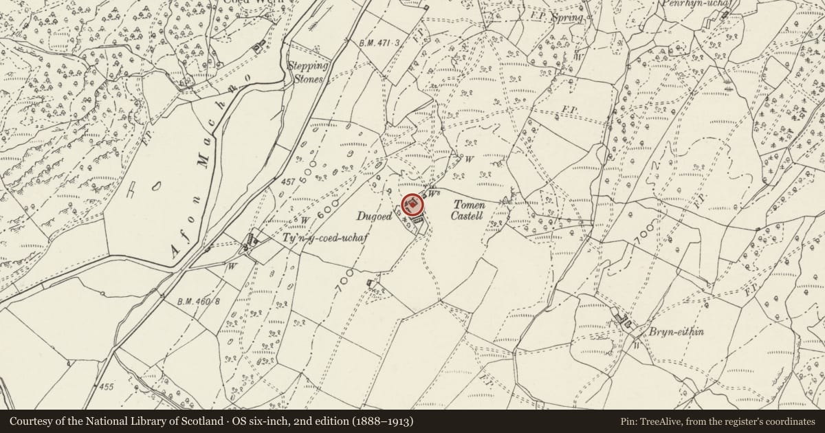
Slide toward Today to fade the historical sheet and see the modern map underneath.
David Rumsey Map Collection, Stanford LibrariesLlyfrgell Genedlaethol Cymru – The National Library of WalesDavid Rumsey Map Collection, Stanford LibrariesDavid Rumsey Map Collection, Stanford LibrariesDavid Rumsey Map Collection, Stanford Libraries
5 historical maps cover this location, the earliest the 1608 map "(13) Cambriae Typus." (David Rumsey Map Collection, Stanford Libraries).
Historical maps covering this location
- 1608 · (13) Cambriae Typus. (David Rumsey Map Collection, Stanford Libraries)
- 1795 · To Sir Watkin Williams-Wynn Bart ... the map of the six counties of North Wales is most… (Llyfrgell Genedlaethol Cymru – The National Library of Wales)
- 1830 · V.3:11-15:XV. Britisches Reich. A. Kon: England. b. Frstenthum Wales: Shire: 37-40 (David Rumsey Map Collection, Stanford Libraries)
- 1883 · Watershed map England, Wales 3. (David Rumsey Map Collection, Stanford Libraries)
- 1901 · Sheet 9 and 10. (David Rumsey Map Collection, Stanford Libraries)
Cadw's description
Location
To E of B4406 above Ty'n-y-Coed Uchaf c 800 metres S of Penmachno Mill.
History
House of c1600 facing SE towards hillside with early C17 N wing to rear at right angles. Renovated C19. Small walled front garden.
Exterior
Two storeys; symmetrical front. Local slate rubble, slate roof. End chimney stacks in stone; that to L rectangular; that to R square, rising from ground level as projecting shouldered chimney. First floor has central small window with vertically-proportioned casement window to each side. Central doorway (slate lintel on corbels) beneath broad gabled porch. To each side of doorway, vertically-proportioned casement windows.
At rear, small window at eaves at angle with N wing. N wing has square stone chimney in N gable. On E front single first floor vertically proportioned casement window set at eaves, apparently reduced in width. On ground floor, to L, doorway with 'Cyclopean' monolithic head and jambs of large upright slabs. To R, three-light casement window.
Rear of block has C19 dairy outshot.
Interior
South part has modern ceiling with original beams. The N wing said to have original beams and joists and an open roof. Beside the fireplace is a winding stone stair.
Nearby in the register
- Root Camp at Ty'n y Coed UchafGardens, Parks and Urban Spacesunder 1 mi
- Bryn Eithin & attached Agricultural RangesDomesticunder 1 mi
- Iscoed CottageDomesticunder 1 mi
- Pont y PandyTransportunder 1 mi
Other entries of the same register within about three miles of this one, by straight line.