Cof Cymru: National Historic Assets of Wales · Wales
Old Toll House
Arthog, Gwynedd, Wales
A Grade II listed building in Friog, Arthog, Gwynedd, designated on 9 November 1987.
The record
- Designation
- Listed building, Grade II
- Broad class
- Transport
- Date of designation
- 9 November 1987
- Locality
- Friog
- Community
- Arthog
- Unitary authority
- Gwynedd
- Country
- Wales
- Coordinates
- 52.68882, -4.05261
- Cadw reference
- 5206
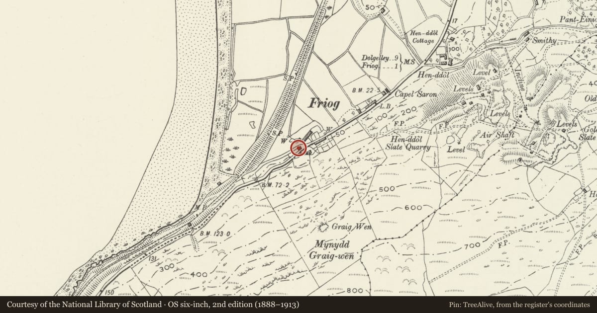
Slide toward Today to fade the historical sheet and see the modern map underneath.
David Rumsey Map Collection, Stanford LibrariesDavid Rumsey Map Collection, Stanford LibrariesDavid Rumsey Map Collection, Stanford LibrariesLlyfrgell Genedlaethol Cymru – The National Library of WalesDavid Rumsey Map Collection, Stanford Libraries
5 historical maps cover this location, the earliest the 1795 map "To Sir Watkin Williams-Wynn Bart ... the map of the six counties of North Wales is most humbly inscribed by his obedient humble servant" (Llyfrgell Genedlaethol Cymru – The National Library of Wales).
Historical maps covering this location
- 1795 · To Sir Watkin Williams-Wynn Bart ... the map of the six counties of North Wales is most… (Llyfrgell Genedlaethol Cymru – The National Library of Wales)
- 1883 · Watershed map England, Wales 3. (David Rumsey Map Collection, Stanford Libraries)
- 1896 · Sheet 7. Ordnance Survey of England and Wales. (David Rumsey Map Collection, Stanford Libraries)
- 1899 · 149 Barmouth (Hills) (David Rumsey Map Collection, Stanford Libraries)
- 1901 · Sheet 9 and 10. (David Rumsey Map Collection, Stanford Libraries)
Cadw's description
Location
Located at the SW end of the village where the coastal road climbs the hills overlooking Barmouth Bay. On an angle site with the beach road branching to the R.
Located at the SW end of the village where the coastal road climbs the hills overlooking Ba
History
Toll house probably contemporary with the construction of the turnpike road at the end of the C18. Assessed in February 1862 as producing ú50. 5s per annum.
Exterior
Single storey; L-plan of whitewashed rubble with slate roof towards Friog and stone slates to rear. Canted bay to N end with hipped roof and projecting porch facing main road; ribbed, boarded door. Central rubble stack with plain cornice and weather coursing; cross-gable to rear with later extension. Simple, slightly recessed 4-pane windows with small casement openings. 2 small C20 skylights to NE pitch of cross-gable.
Reason for designation
Listed as a well-preserved example of a scarce building type withspecial historic interest.
Nearby in the register
- New InnCommercialunder 1 mi
- L-Shaped Agricultural Range at Hen-DdolAgriculture and Subsistenceunder 1 mi
- Hen-Ddol Farmhouse including attached Outbuilding to N Ffordd HenddolDomesticunder 1 mi
- Hut Enclosure and Early Field System South of Mynydd GraigwenField Systemunder 1 mi
Other entries of the same register within about three miles of this one, by straight line.