Cof Cymru: National Historic Assets of Wales · Wales
Lychgate at the Church of St Mary and St Egryn
Llanegryn, Gwynedd, Wales
A Grade II listed building in Llanegryn, Gwynedd, designated on 17 June 1966.
The record
- Designation
- Listed building, Grade II
- Broad class
- Religious, Ritual and Funerary
- Date of designation
- 17 June 1966
- Locality
- Llanegryn
- Community
- Llanegryn
- Unitary authority
- Gwynedd
- Country
- Wales
- Coordinates
- 52.63161, -4.07480
- Cadw reference
- 4730
Slide toward Today to fade the historical sheet and see the modern map underneath.
David Rumsey Map Collection, Stanford LibrariesDavid Rumsey Map Collection, Stanford LibrariesDavid Rumsey Map Collection, Stanford LibrariesDavid Rumsey Map Collection, Stanford LibrariesLlyfrgell Genedlaethol Cymru – The National Library of Wales
5 historical maps cover this location, the earliest the 1795 map "To Sir Watkin Williams-Wynn Bart ... the map of the six counties of North Wales is most humbly inscribed by his obedient humble servant" (Llyfrgell Genedlaethol Cymru – The National Library of Wales).
Historical maps covering this location
- 1795 · To Sir Watkin Williams-Wynn Bart ... the map of the six counties of North Wales is most… (Llyfrgell Genedlaethol Cymru – The National Library of Wales)
- 1883 · Watershed map England, Wales 3. (David Rumsey Map Collection, Stanford Libraries)
- 1896 · Sheet 7. Ordnance Survey of England and Wales. (David Rumsey Map Collection, Stanford Libraries)
- 1899 · 149 Barmouth (Hills) (David Rumsey Map Collection, Stanford Libraries)
- 1901 · Sheet 9 and 10. (David Rumsey Map Collection, Stanford Libraries)
Cadw's description
Location
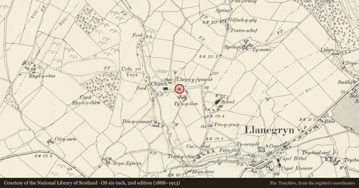
The church stands c500-600m N of the present village. The lychgate forms the entrance to the churchyard from the E.
History
The churchyard around the medieval church was originally round or oval, but was extended in 1883 to its present form and the lychgate, originally built in the later C15, was re-set in its present position at the new E entrance.
Exterior
The lychgate is built with stone and slate side walls c2m high carrying front and back trusses supporting the old slate roof. Slightly cusped bargeboards.
Interior
The front and back trusses consist of principal rafters cusped above the knee-braced collars. Ladder wall plates with ashlars rising from the inner plate. Chamfered purlins with cusped wind braces each side. The soffit of the roof is boarded.
Reason for designation
Included as an interesting survival of a medieval lychgate, and one where the roof construction shows affinities on a much smaller scale with the medieval roofs of the church and its porch.
Nearby in the register
- Church of St Mary and St EgrynReligious, Ritual and Funeraryunder 1 mi
- Barn at Tynewydd, adjoining Rhine CottageDomesticunder 1 mi
- Rhine CottageDomesticunder 1 mi
- BodegrynDomesticunder 1 mi
Other entries of the same register within about three miles of this one, by straight line.