Cof Cymru: National Historic Assets of Wales · Wales
Alliance & Leicester and Abby National Building Societies
Pwllheli, Gwynedd, Wales
A Grade II listed building in Pwllheli, Gwynedd, designated on 28 July 1989.
The record
- Designation
- Listed building, Grade II
- Broad class
- Commercial
- Date of designation
- 28 July 1989
- Community
- Pwllheli
- Unitary authority
- Gwynedd
- Country
- Wales
- Coordinates
- 52.88984, -4.41559
- Cadw reference
- 4513
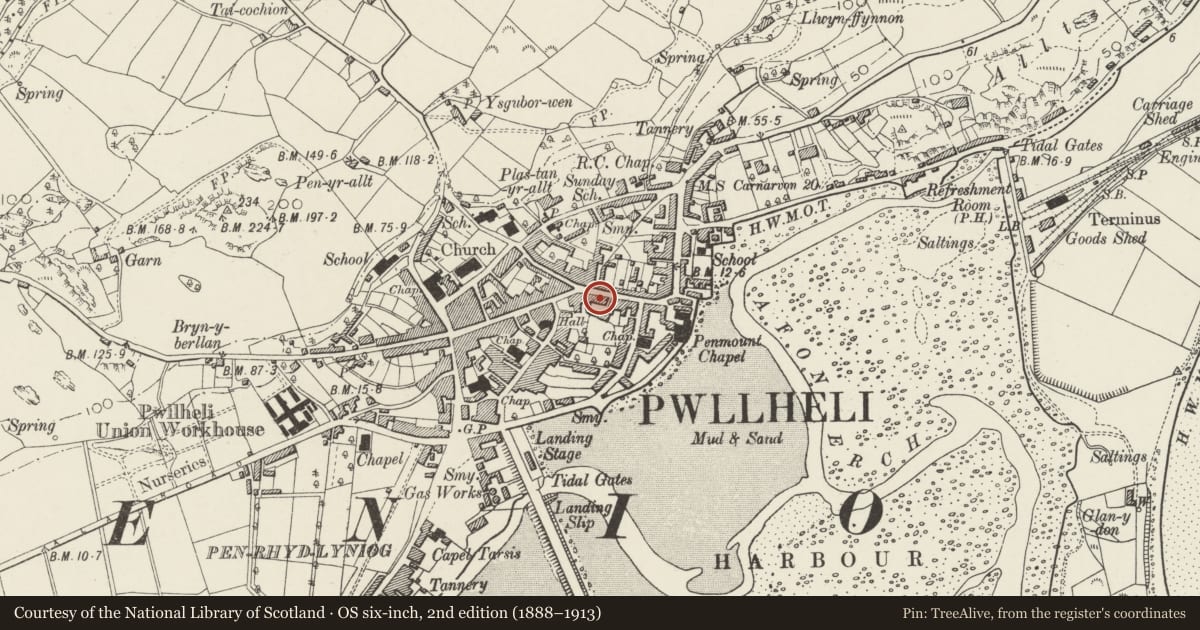
Slide toward Today to fade the historical sheet and see the modern map underneath.
David Rumsey Map Collection, Stanford LibrariesDavid Rumsey Map Collection, Stanford LibrariesDavid Rumsey Map Collection, Stanford LibrariesDavid Rumsey Map Collection, Stanford LibrariesDavid Rumsey Map Collection, Stanford Libraries
5 historical maps cover this location, the earliest the 1830 map "V.3:11-15:XV. Britisches Reich. A. Kon: England. b. Frstenthum Wales: Shire: 37-40" (David Rumsey Map Collection, Stanford Libraries).
Historical maps covering this location
- 1830 · V.3:11-15:XV. Britisches Reich. A. Kon: England. b. Frstenthum Wales: Shire: 37-40 (David Rumsey Map Collection, Stanford Libraries)
- 1883 · Watershed map England, Wales 3. (David Rumsey Map Collection, Stanford Libraries)
- 1896 · Sheet 7. Ordnance Survey of England and Wales. (David Rumsey Map Collection, Stanford Libraries)
- 1899 · 134 Pwllheli (Hills) (David Rumsey Map Collection, Stanford Libraries)
- 1901 · Sheet 9 and 10. (David Rumsey Map Collection, Stanford Libraries)
Cadw's description
Location
Set into a row of frontages slightly stepped back from No 38 near the area formerly known as Caroline Square.
History
Built in late C18 as the town house of the Madryn family; later became the Madryn Arms PH and in 1892 the Post Office was opened here.
Exterior
Broad 3-storey 5-window stucco front with slate roof and bracket eaves. 12-pane sash windows to 1st and 2nd floors, those to 4th bay are blocked. Above the main entrance, to left of centre, are French windows formerly opening onto a balcony. Modernised ground floor with high transoms to windows of varying widths, that to right is set in the segmental arched former carriage entry with quoins, voussoirs and keystones; at some time this may have been made into a narrow doorway as a step remains. 6-panel door and raised and moulded surround to Abbey National fascia.
Cement render rear with modern windows overlooking the formerly cobbled yard; steps down to cellar.
Interior
The interior retains panelled shutters and 6-panel doors and the staircase has turned balusters at the newel.
The main room (that which formerly opened onto the balcony) has especially lavish detail including Gothic embossed patterning to the rear panels of the door and very unusual highly ornate cast-iron pelmet.
Reason for designation
Group value.
Nearby in the register
- National Westminster BankCommercialunder 1 mi
- 38 High StreetDomesticunder 1 mi
- 35 High StreetDomesticunder 1 mi
- Lleyn FurnishersCommercialunder 1 mi
Other entries of the same register within about three miles of this one, by straight line.