Cof Cymru: National Historic Assets of Wales · Wales
38 High Street
Pwllheli, Gwynedd, Wales
A Grade II listed building in Pwllheli, Gwynedd, designated on 28 July 1989.
The record
- Designation
- Listed building, Grade II
- Broad class
- Domestic
- Date of designation
- 28 July 1989
- Community
- Pwllheli
- Unitary authority
- Gwynedd
- Country
- Wales
- Coordinates
- 52.88986, -4.41581
- Cadw reference
- 4514
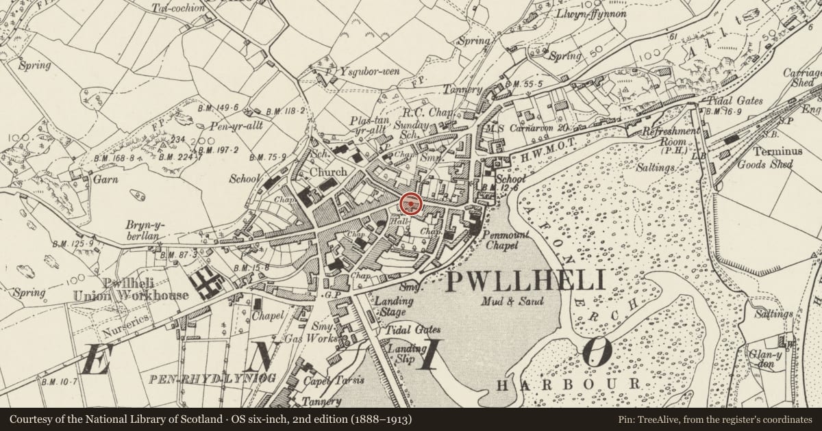
Slide toward Today to fade the historical sheet and see the modern map underneath.
David Rumsey Map Collection, Stanford LibrariesDavid Rumsey Map Collection, Stanford LibrariesDavid Rumsey Map Collection, Stanford LibrariesDavid Rumsey Map Collection, Stanford LibrariesDavid Rumsey Map Collection, Stanford Libraries
5 historical maps cover this location, the earliest the 1830 map "V.3:11-15:XV. Britisches Reich. A. Kon: England. b. Frstenthum Wales: Shire: 37-40" (David Rumsey Map Collection, Stanford Libraries).
Historical maps covering this location
- 1830 · V.3:11-15:XV. Britisches Reich. A. Kon: England. b. Frstenthum Wales: Shire: 37-40 (David Rumsey Map Collection, Stanford Libraries)
- 1883 · Watershed map England, Wales 3. (David Rumsey Map Collection, Stanford Libraries)
- 1896 · Sheet 7. Ordnance Survey of England and Wales. (David Rumsey Map Collection, Stanford Libraries)
- 1899 · 134 Pwllheli (Hills) (David Rumsey Map Collection, Stanford Libraries)
- 1901 · Sheet 9 and 10. (David Rumsey Map Collection, Stanford Libraries)
Cadw's description
Location
Set in a continuous row of frontages on the bend in the road, in the area formerly known as Caroline Square.
History
Georgian, probably late C18; some alterations in 1843 (see dated rainwater head). Shown on John Wood’s 1834 map as the George and Dragon PH.
Exterior
3-storey, 4-window stucco front with panelled attic and cellar opening to left; the right hand windows have been blocked to 1st and 2nd floors. The front splays back slightly to left. Slate roof, red brick chimney stacks and bracket eaves; 12 pane sash windows. The ground floor has a 16-pane sash to left (? Former shop window) with wooden entablature that continues to right over the doorway to which has been added a Doric porch with cast iron columns; 6-panel door with traceried panelled fanlight. The entablature may have once extended to right over a previous shop front - now a later C19 example with broad window and pilasters; swept coping to cornice.
Rubble cross range to rear with modern extension.
Interior
Altered plan form with narrow full height stairwell to right. Attached former kitchen range at rear has open roof.
Reason for designation
Group value.
Nearby in the register
- Lleyn FurnishersCommercialunder 1 mi
- Alliance & Leicester and Abby National Building SocietiesCommercialunder 1 mi
- Abbey NationalCommercialunder 1 mi
- HarpersCommercialunder 1 mi
Other entries of the same register within about three miles of this one, by straight line.