Cof Cymru: National Historic Assets of Wales · Wales
National Westminster Bank
Pwllheli, Gwynedd, Wales
A Grade II listed building in Pwllheli, Gwynedd, designated on 28 July 1989.
The record
- Designation
- Listed building, Grade II
- Broad class
- Commercial
- Date of designation
- 28 July 1989
- Community
- Pwllheli
- Unitary authority
- Gwynedd
- Country
- Wales
- Coordinates
- 52.88981, -4.41545
- Cadw reference
- 4512
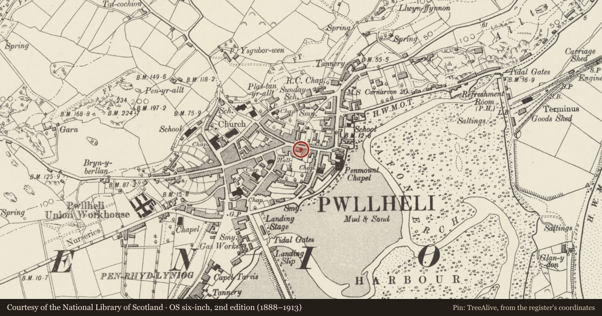
Slide toward Today to fade the historical sheet and see the modern map underneath.
David Rumsey Map Collection, Stanford LibrariesDavid Rumsey Map Collection, Stanford LibrariesDavid Rumsey Map Collection, Stanford LibrariesDavid Rumsey Map Collection, Stanford LibrariesDavid Rumsey Map Collection, Stanford Libraries
5 historical maps cover this location, the earliest the 1830 map "V.3:11-15:XV. Britisches Reich. A. Kon: England. b. Frstenthum Wales: Shire: 37-40" (David Rumsey Map Collection, Stanford Libraries).
Historical maps covering this location
- 1830 · V.3:11-15:XV. Britisches Reich. A. Kon: England. b. Frstenthum Wales: Shire: 37-40 (David Rumsey Map Collection, Stanford Libraries)
- 1883 · Watershed map England, Wales 3. (David Rumsey Map Collection, Stanford Libraries)
- 1896 · Sheet 7. Ordnance Survey of England and Wales. (David Rumsey Map Collection, Stanford Libraries)
- 1899 · 134 Pwllheli (Hills) (David Rumsey Map Collection, Stanford Libraries)
- 1901 · Sheet 9 and 10. (David Rumsey Map Collection, Stanford Libraries)
Cadw's description
Location
In the eastern part of the High Street, detached to left.
History
Dates from late C18 when if formed part of the contemporary former Madryn town house. Later became the Plas Inn PH. Extended to left and given a Classical banking front sometime between 1891 and 1898.
Exterior
2+2-window scribed stucco front, the earlier part is 3-storey and the later part, 2-storey. Slate roofs with brick chimney stacks and flat roof dormer; parapet to left. 12 pane sash windows, those on the 1st floor have lugged architraves with carved brackets to segmental pedimented heads, later windows are horned; 1st floor cill band. Overall cornice and entablature to ground floor which is channel rusticated; 4 round arched headed banking hall windows with keystones and architraves. Round arched doorway to right with rusticated voussoirs below squared head; panelled pilasters and recessed panelled double doors. Modern bank fittings set into high plinth.
The earlier part of the building extends further to rear; cross range and modern flat roof extension.
Reason for designation
Group value.
Nearby in the register
- Alliance & Leicester and Abby National Building SocietiesCommercialunder 1 mi
- Former Coach House to rear of no.32Domesticunder 1 mi
- 35 High StreetDomesticunder 1 mi
- 33 High StreetDomesticunder 1 mi
Other entries of the same register within about three miles of this one, by straight line.