Cof Cymru: National Historic Assets of Wales · Wales
Llanfair Arms PH
Llanfairfechan, Conwy, Wales
A Grade II listed building in Llanfairfechan, Conwy, designated on 14 April 1992.
The record
- Designation
- Listed building, Grade II
- Broad class
- Commercial
- Date of designation
- 14 April 1992
- Locality
- Llanfairfechan
- Community
- Llanfairfechan
- Unitary authority
- Conwy
- Country
- Wales
- Coordinates
- 53.25206, -3.97425
- Cadw reference
- 3556
Slide toward Today to fade the historical sheet and see the modern map underneath.
David Rumsey Map Collection, Stanford LibrariesDavid Rumsey Map Collection, Stanford LibrariesDavid Rumsey Map Collection, Stanford LibrariesDavid Rumsey Map Collection, Stanford LibrariesDavid Rumsey Map Collection, Stanford Libraries
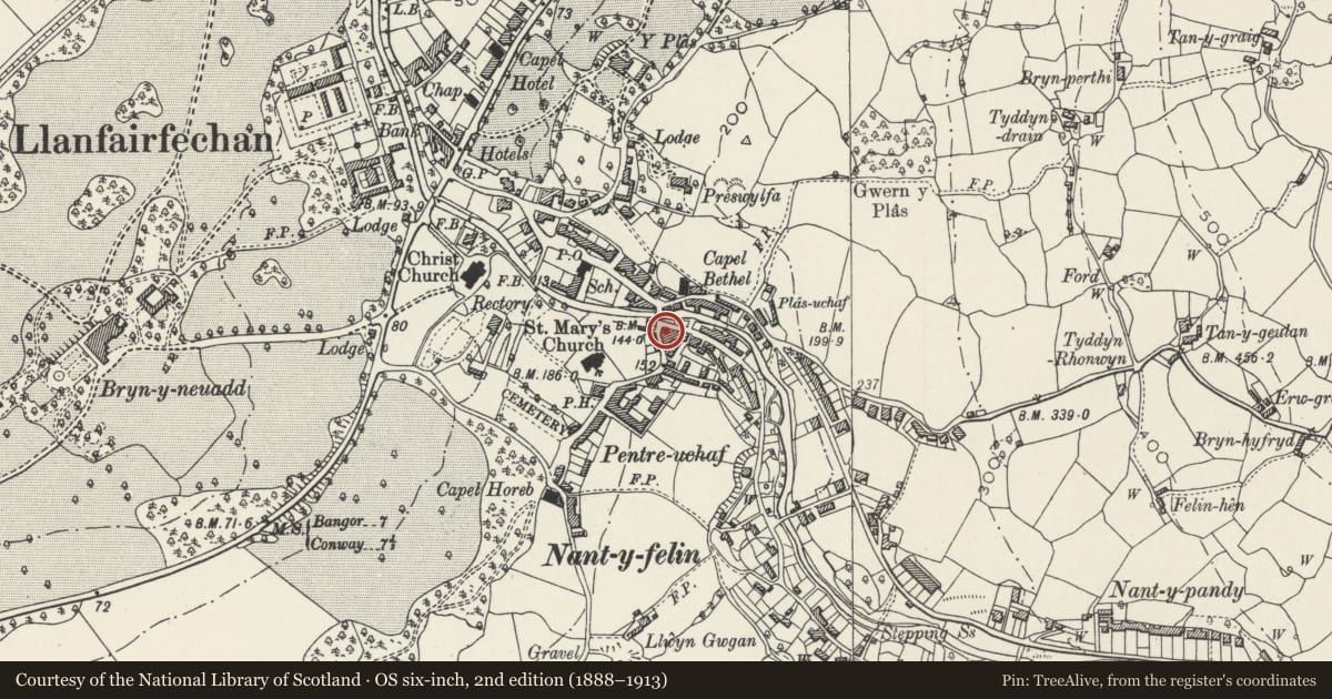
5 historical maps cover this location, the earliest the 1883 map "Watershed map England, Wales 3." (David Rumsey Map Collection, Stanford Libraries).
Historical maps covering this location
- 1883 · Watershed map England, Wales 3. (David Rumsey Map Collection, Stanford Libraries)
- 1896 · Sheet 7. Ordnance Survey of England and Wales. (David Rumsey Map Collection, Stanford Libraries)
- 1899 · 106 Bangor (Outline) (David Rumsey Map Collection, Stanford Libraries)
- 1899 · 106 Bangor (Hills) (David Rumsey Map Collection, Stanford Libraries)
- 1901 · Sheet 9 and 10. (David Rumsey Map Collection, Stanford Libraries)
Cadw's description
Location
On corner of Mill Road and Penybryn Road, with main front facing Mill Road and Afon Llanfairfechan (N).
History
Built 1863 by Hugh Davies of Erw Gron for Robert Roberts.
Exterior
Two storey public house in rubble, squared to front. Slate roof; and chimneys in rubble. On first floor, three 16 pane hornless sash windows. On ground floor full width shallow extension bay in matching materials, central double doorway; small pane glazing to sides. To right (W), gable with overhanging eaves. Two and a half storeys. Two small 6 pane hornless sash windows in gable. On first floor, 2 widely spaced 16 pane hornless sash windows. On ground floor, 2 doorways towards R of elevation. To right of gable end,
2-storey splayed extension in matching materials. Single chimney to rear. On first floor, two 16 pane hornless sash windows; on ground floor, two 12 pane sash windows, and doorway.
Reason for designation
Group value with neighbouring buildings in Mill Road and Penybryn Road.
Nearby in the register
- The Original Fish & Chip ShopCommercialunder 1 mi
- Pont-y-PentreTransportunder 1 mi
- Cottage at Pont-y-PentreDomesticunder 1 mi
- BodafonDomesticunder 1 mi
Other entries of the same register within about three miles of this one, by straight line.