Cof Cymru: National Historic Assets of Wales · Wales
Tabernacle Baptist Church
Trevethin, Torfaen, Wales
A Grade II listed building in Old Penygarn, Pontypool, Trevethin, Torfaen, designated on 12 December 1972.
The record
- Designation
- Listed building, Grade II
- Broad class
- Religious, Ritual and Funerary
- Date of designation
- 12 December 1972
- Locality
- Old Penygarn
- Town
- Pontypool
- Community
- Trevethin
- Unitary authority
- Torfaen
- Country
- Wales
- Coordinates
- 51.70809, -3.03585
- Cadw reference
- 3129
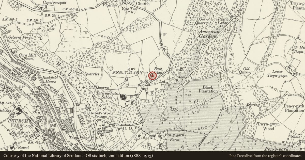
Slide toward Today to fade the historical sheet and see the modern map underneath.
David Rumsey Map Collection, Stanford LibrariesDavid Rumsey Map Collection, Stanford LibrariesDavid Rumsey Map Collection, Stanford LibrariesDavid Rumsey Map Collection, Stanford LibrariesDavid Rumsey Map Collection, Stanford Libraries
5 historical maps cover this location, the earliest the 1636 map "Cornubia : Devonia, Somersetus, Dorcestria, Wiltonia, Glocestria ..." (David Rumsey Map Collection, Stanford Libraries).
Historical maps covering this location
- 1636 · Cornubia : Devonia, Somersetus, Dorcestria, Wiltonia, Glocestria ... (David Rumsey Map Collection, Stanford Libraries)
- 1637 · The fourth table of England. Cornub. Devonia, Somerset etc. (David Rumsey Map Collection, Stanford Libraries)
- 1830 · V.3:11-15:XV.Britisches Reich. A. Kon: England. a. England ab sich: Shire:15-17, 33 (David Rumsey Map Collection, Stanford Libraries)
- 1895 · Sheet 11. Ordnance Survey of England and Wales. (David Rumsey Map Collection, Stanford Libraries)
- 1913 · Sheet 102. Newport. (David Rumsey Map Collection, Stanford Libraries)
Cadw's description
Location
Set back from the road at the north end of Penygarn in an area of late Victorian and modern housing but with its own quite extensive cemetery.
History
A Chapel built in 1727 with a porch added in 1925. The chapel was unused as such for some years but was re-occupied by the congregation when the Pontypool Tabernacle Baptist Church was given up in 1969.
Exterior
Dated 1727 with porch added in 1925, also dated. White-washed small rubble, the porch is squared and coursed. Stone tiled roof with bracketed eaves, end gables. Single cell rectangular building, but deliberately given the appearance of a two storey central entrance house on the outside. Two windows on upper and lower levels, square-headed in flush frames, with 9 over 9 modern, small-paned windows which have top-opening lights. Gabled stone porch with tablet - 'Erected by E Propyn, Esq. J.P. Pontypool, Deacon 1925'. Modern plank door. Small stone stack on left gable.
Rear elevation with two similar windows and a small projecting single storey wing. There is also an older central window at a lower height which originally lit the pulpit. Raking buttress. The rear elevation remains unpainted.
The chapel has a small paved area in front built up to road level with two chest tombs of interest which are listed separately.
Interior
Interior plain with pews and other furnishings from the Tabernacle Baptist Church in Pontypool town centre (now demolished). The pulpit surives but is now on the east wall. Small gallery at west end with a splat baluster front and interesting original staircase; it is recorded that there were galleries on the east and west walls as well in 1906. King post roof partly ceiled. The chapel was closed for many years as the chief Welsh Baptist congregation was at the Tabernacle Baptist Church in Crane Street, Pontypool, but this was demolished in about 1970 and the congregation moved back to the former church. It is not known when the main internal changes took place, but it was not at that time.
Reason for designation
An early Baptist Chapel in a partly altered condition; it dates from a period when it was still necessary to give a Chapel a domestic appearance.
Nearby in the register
- Tomb of William Edmunds at Tabernacle Baptist ChurchReligious, Ritual and Funeraryunder 1 mi
- Tomb of John Phillips at Tabernacle Baptist ChurchReligious, Ritual and Funeraryunder 1 mi
- Park CottageDomesticunder 1 mi
- Tomb of Margaret Davies in St. Cadoc's Churchyard.Religious, Ritual and Funeraryunder 1 mi
Other entries of the same register within about three miles of this one, by straight line.