Cof Cymru: National Historic Assets of Wales · Wales
Park Cottage
Pontymoile, Torfaen, Wales
A Grade II listed building in Penygarn, Pontypool, Pontymoile, Torfaen, designated on 19 May 1981.
The record
- Designation
- Listed building, Grade II
- Broad class
- Domestic
- Date of designation
- 19 May 1981
- Locality
- Penygarn
- Town
- Pontypool
- Community
- Pontymoile
- Unitary authority
- Torfaen
- Country
- Wales
- Coordinates
- 51.70444, -3.03521
- Cadw reference
- 3145
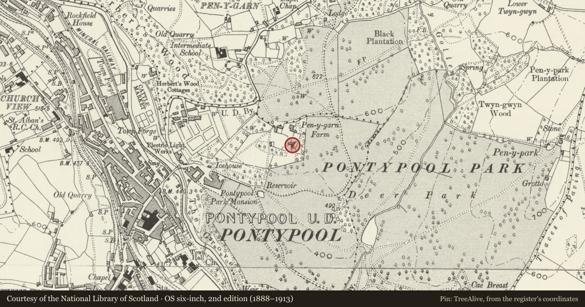
Slide toward Today to fade the historical sheet and see the modern map underneath.
David Rumsey Map Collection, Stanford LibrariesDavid Rumsey Map Collection, Stanford LibrariesDavid Rumsey Map Collection, Stanford LibrariesDavid Rumsey Map Collection, Stanford LibrariesDavid Rumsey Map Collection, Stanford Libraries
5 historical maps cover this location, the earliest the 1636 map "Cornubia : Devonia, Somersetus, Dorcestria, Wiltonia, Glocestria ..." (David Rumsey Map Collection, Stanford Libraries).
Historical maps covering this location
- 1636 · Cornubia : Devonia, Somersetus, Dorcestria, Wiltonia, Glocestria ... (David Rumsey Map Collection, Stanford Libraries)
- 1637 · The fourth table of England. Cornub. Devonia, Somerset etc. (David Rumsey Map Collection, Stanford Libraries)
- 1830 · V.3:11-15:XV.Britisches Reich. A. Kon: England. a. England ab sich: Shire:15-17, 33 (David Rumsey Map Collection, Stanford Libraries)
- 1895 · Sheet 11. Ordnance Survey of England and Wales. (David Rumsey Map Collection, Stanford Libraries)
- 1913 · Sheet 102. Newport. (David Rumsey Map Collection, Stanford Libraries)
Cadw's description
Location
On the north side of Pontypool Park in Penygarn, it is situated down a private drive off the end of St. David's Close.
History
A probably late C17 two cell house which was divided into two probably in the C18 and has been reconverted to one since listing in 1981. The house has been completely modernised and added to in recent years.
Exterior
A probably late C17 house, perhaps converted to a pair of cottages in C18, now once again one house and completely modernised and with additions since listing. Roughly squared and coursed limestone rubble with an artificial stone slate roof. One and a half storeys and with four casement windows with a doorway in the centre. This was a two cell single depth house, but an additional room, with an extra window and dormer, has been added on the left hand end since listing in 1981. Three gabled dormers in steeply pitched roof with two brick gable stacks. Two small lights in the south gable end. Rear elevation has an extension, modern lattice casements and four rooflights.
Interior
Interior not available at time of resurvey, but the previous list description reports semi-spiral chimney stairs, evidence of former post and panel partition and stop chamfered beams.
Reason for designation
Listed for the special interest of its sub-medieval origins, not withstanding the modern alterations.
Nearby in the register
- Double icehouse in Pontypool ParkDomesticunder 1 mi
- St Alban's Catholic SchoolReligious, Ritual and Funeraryunder 1 mi
- The Valley Inheritance MuseumEducationunder 1 mi
- Park CottagesDomesticunder 1 mi
Other entries of the same register within about three miles of this one, by straight line.