Cof Cymru: National Historic Assets of Wales · Wales
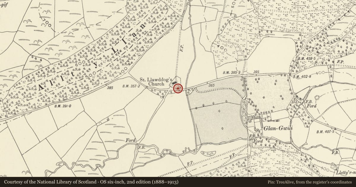
Pound in churchyard wall of Church of St Llawddog
Llanllawddog, Carmarthenshire, Wales
A Grade II listed building in Llanllawddog, Carmarthenshire, designated on 12 September 2002.
The record
- Designation
- Listed building, Grade II
- Broad class
- Agriculture and Subsistence
- Date of designation
- 12 September 2002
- Locality
- Llanllawddog
- Community
- Llanllawddog
- Unitary authority
- Carmarthenshire
- Country
- Wales
- Coordinates
- 51.94157, -4.24476
- Cadw reference
- 26936
Slide toward Today to fade the historical sheet and see the modern map underneath.
David Rumsey Map Collection, Stanford LibrariesDavid Rumsey Map Collection, Stanford LibrariesDavid Rumsey Map Collection, Stanford LibrariesDavid Rumsey Map Collection, Stanford LibrariesDavid Rumsey Map Collection, Stanford Libraries
5 historical maps cover this location, the earliest the 1636 map "Cornubia : Devonia, Somersetus, Dorcestria, Wiltonia, Glocestria ..." (David Rumsey Map Collection, Stanford Libraries).
Historical maps covering this location
- 1636 · Cornubia : Devonia, Somersetus, Dorcestria, Wiltonia, Glocestria ... (David Rumsey Map Collection, Stanford Libraries)
- 1860 · 41. Caermathen. (David Rumsey Map Collection, Stanford Libraries)
- 1891 · Sheet 10. Ordnance Survey of England and Wales. . (David Rumsey Map Collection, Stanford Libraries)
- 1898 · 211 Newcastle Emlyn (Hills) (David Rumsey Map Collection, Stanford Libraries)
- 1901 · Sheet 14. (David Rumsey Map Collection, Stanford Libraries)
Cadw's description
Location
On the S side of the church.
History
Built in the C18 or early C19 and shown on the 1838 Tithe map at the SE corner of the churchyard. The churchyard was extended E when the church was rebuilt in 1848-9, at which time an extension of the rubble stone boundary wall was built abutting the E side of the pound. The entrance to the pound is an alteration of the mid or late C19.
Exterior
A sub-circular pound of rubble stone with C20 cock-and-hen coping course. On the E side is a camber-headed doorway with dressed voussoirs and rock-faced keystone. On the S side facing the road is a narrow loop. The churchyard wall abuts the E and W sides.
Reason for designation
Listed for its special historic interest as a rare surviving small pound, a building type once familiar in rural Wales.
Nearby in the register
- Y DderwynDomesticunder 1 mi
- Alltwalis Independent Chapel, including vestry to rearReligious, Ritual and Funerary2 mi
- Crug-y-rhud-hir round barrowRound Barrow2 mi
- Cross-Incised Stone in ChurchyardCross-marked stone2 mi
Other entries of the same register within about three miles of this one, by straight line.