Cof Cymru: National Historic Assets of Wales · Wales
Retaining wall to Pier Hill and former lifeboat house
Tenby, Pembrokeshire, Wales
A Grade II listed building in Tenby, Pembrokeshire, designated on 19 March 1951.
The record
- Designation
- Listed building, Grade II
- Broad class
- Maritime
- Date of designation
- 19 March 1951
- Town
- Tenby
- Community
- Tenby
- Unitary authority
- Pembrokeshire
- Country
- Wales
- Coordinates
- 51.67257, -4.69679
- Cadw reference
- 26361
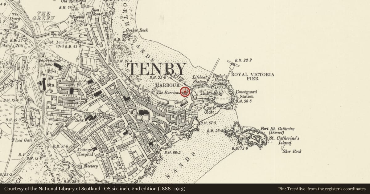
Slide toward Today to fade the historical sheet and see the modern map underneath.
David Rumsey Map Collection, Stanford LibrariesDavid Rumsey Map Collection, Stanford LibrariesDavid Rumsey Map Collection, Stanford LibrariesDavid Rumsey Map Collection, Stanford LibrariesDavid Rumsey Map Collection, Stanford Libraries
5 historical maps cover this location, the earliest the 1636 map "Cornubia : Devonia, Somersetus, Dorcestria, Wiltonia, Glocestria ..." (David Rumsey Map Collection, Stanford Libraries).
Historical maps covering this location
- 1636 · Cornubia : Devonia, Somersetus, Dorcestria, Wiltonia, Glocestria ... (David Rumsey Map Collection, Stanford Libraries)
- 1865 · England and Wales. England No. 6. (David Rumsey Map Collection, Stanford Libraries)
- 1891 · Sheet 10. Ordnance Survey of England and Wales. . (David Rumsey Map Collection, Stanford Libraries)
- 1898 · 245 Pembroke (Hills) (David Rumsey Map Collection, Stanford Libraries)
- 1901 · Sheet 13. (David Rumsey Map Collection, Stanford Libraries)
Cadw's description
Location
Situated on the E side of the harbour.
History
Retaining wall to the harbour access, C19 masonry, but presumably on the line of the original harbour approach. Shown on 1817 Charles Norris view. The old lifeboat house, built in 1852 by the Shipwrecked Fishermen and Mariners Royal Benevolent Soc. for the first Tenby lifeboat and in use until the construction of a new house on Castle Beach in 1862, is a lean-to structure between the wall and the Fishermen's Rooms.
Exterior
Retaining wall, squared rock-faced grey limestone, with rubble stone sloping parapet wall along Pier Hill. Wall rises in heignt from N end curved junction with pier to high S end against Penniless Cove Hill. Lifeboat house is a lean-to structure against right hand end, between wall and the Fishermen's Rooms. Slate lean-to roof and grey stone tooled jambs to entry, shouldered in to carry lintel.
Reason for designation
Included for group value with the other Harbour structures and the houses on Pier Hill.
Nearby in the register
- 2 Pier HillDomesticunder 1 mi
- 3 Pier HillDomesticunder 1 mi
- 1 Pier HillDomesticunder 1 mi
- The former Albion HotelDomesticunder 1 mi
Other entries of the same register within about three miles of this one, by straight line.