Cof Cymru: National Historic Assets of Wales · Wales
2 Pier Hill
Tenby, Pembrokeshire, Wales
A Grade II listed building in Tenby, Pembrokeshire, designated on 26 April 1977.
The record
- Designation
- Listed building, Grade II
- Broad class
- Domestic
- Date of designation
- 26 April 1977
- Town
- Tenby
- Community
- Tenby
- Unitary authority
- Pembrokeshire
- Country
- Wales
- Coordinates
- 51.67254, -4.69665
- Cadw reference
- 26326
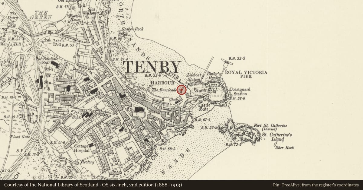
Slide toward Today to fade the historical sheet and see the modern map underneath.
David Rumsey Map Collection, Stanford LibrariesDavid Rumsey Map Collection, Stanford LibrariesDavid Rumsey Map Collection, Stanford LibrariesDavid Rumsey Map Collection, Stanford LibrariesDavid Rumsey Map Collection, Stanford Libraries
5 historical maps cover this location, the earliest the 1636 map "Cornubia : Devonia, Somersetus, Dorcestria, Wiltonia, Glocestria ..." (David Rumsey Map Collection, Stanford Libraries).
Historical maps covering this location
- 1636 · Cornubia : Devonia, Somersetus, Dorcestria, Wiltonia, Glocestria ... (David Rumsey Map Collection, Stanford Libraries)
- 1865 · England and Wales. England No. 6. (David Rumsey Map Collection, Stanford Libraries)
- 1891 · Sheet 10. Ordnance Survey of England and Wales. . (David Rumsey Map Collection, Stanford Libraries)
- 1898 · 245 Pembroke (Hills) (David Rumsey Map Collection, Stanford Libraries)
- 1901 · Sheet 13. (David Rumsey Map Collection, Stanford Libraries)
Cadw's description
Location
Facing the harbour on the bend halfway up Pier Hill.
History
House, part of row of three on slope of Pier Hill. Possibly depicted with No 3 as low cottage row in Charles Norris 1817 view of Tenby, marked on 1849 map.
Exterior
House, white painted roughcast with slate close-eaved roof, facade curving at right, continuous with No 1 adjoining. Rendered left stack, stuccoed right stack forward of ridge, on party wall with No 1. Two late C20 16-pane sashes above, with thin sills, and 2 C20 4-pane sashes below, not aligned, one to centre and the one to right in former doorway.
Rear to Castle Square is single-storey with parapet stepped up from rear of no 3 to right, and roof slightly lower than roof of No 3. Rendered right end stack. C20 door (to The Cottage, 2 Pier Hill) and C20 window.
Reason for designation
Included as part of the picturesque row of houses facing over the harbour.
Nearby in the register
- 3 Pier HillDomesticunder 1 mi
- 1 Pier HillDomesticunder 1 mi
- Retaining wall to Pier Hill and former lifeboat houseMaritimeunder 1 mi
- The former Albion HotelDomesticunder 1 mi
Other entries of the same register within about three miles of this one, by straight line.