Cof Cymru: National Historic Assets of Wales · Wales
Stable at Bryn Tudor
Halkyn, Flintshire, Wales
A Grade II listed building in Black Brook, Holywell, Halkyn, Flintshire, designated on 31 January 2002.
The record
- Designation
- Listed building, Grade II
- Broad class
- Domestic
- Date of designation
- 31 January 2002
- Locality
- Black Brook
- Town
- Holywell
- Community
- Halkyn
- Unitary authority
- Flintshire
- Country
- Wales
- Coordinates
- 53.18547, -3.14509
- Cadw reference
- 26219
Slide toward Today to fade the historical sheet and see the modern map underneath.
David Rumsey Map Collection, Stanford LibrariesDavid Rumsey Map Collection, Stanford LibrariesDavid Rumsey Map Collection, Stanford LibrariesDavid Rumsey Map Collection, Stanford LibrariesLlyfrgell Genedlaethol Cymru – The National Library of Wales
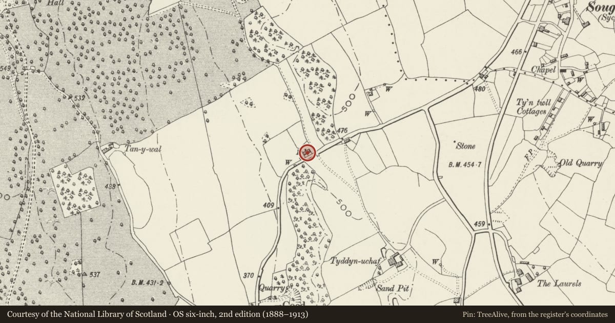
5 historical maps cover this location, the earliest the 1795 map "To Sir Watkin Williams-Wynn Bart ... the map of the six counties of North Wales is most humbly inscribed by his obedient humble servant" (Llyfrgell Genedlaethol Cymru – The National Library of Wales).
Historical maps covering this location
- 1795 · To Sir Watkin Williams-Wynn Bart ... the map of the six counties of North Wales is most… (Llyfrgell Genedlaethol Cymru – The National Library of Wales)
- 1883 · Watershed map England, Wales 3. (David Rumsey Map Collection, Stanford Libraries)
- 1898 · 108 Flint (Hills) (David Rumsey Map Collection, Stanford Libraries)
- 1898 · 108 Flint (Outline) (David Rumsey Map Collection, Stanford Libraries)
- 1901 · Sheet 9 and 10. (David Rumsey Map Collection, Stanford Libraries)
Cadw's description
Location
On the SW side of the house.
History
Part of the Gwysaney Estate and built in the mid C19, probably with the rebuilding of the cottage. It is shown on the Ordnance Survey of 1870. Gwysaney was built in 1603 but the historic character of the estate is derived principally from its redevelopment and enlargement after Philip Davies-Cooke inherited Gwysaney in 1821.
Exterior
Rubble stone stable with coped gables and slate roof. The front has a boarded door, the gable ends have small vent strips beneath the apex. Against the L gable end is a short link wall to a monopitched projection with slate roof and brick stack, which has a further projection behind. The rear of the stable has an iron-framed small-pane window incorporating sliding vents.
Interior
Not inspected.
Reason for designation
Listed for group value with Bryn Tudor and for its contribution to the historic character of the Gwysaney Estate.
Nearby in the register
- Bryn TudorDomesticunder 1 mi
- Tyddyn Uchaf FarmhouseDomesticunder 1 mi
- IslwynDomesticunder 1 mi
- Ty DrawDomesticunder 1 mi
Other entries of the same register within about three miles of this one, by straight line.