Cof Cymru: National Historic Assets of Wales · Wales
Tyddyn Uchaf Farmhouse
Mold, Flintshire, Wales
A Grade II listed building in Mold, Flintshire, designated on 30 March 1987.
The record
- Designation
- Listed building, Grade II
- Broad class
- Domestic
- Date of designation
- 30 March 1987
- Community
- Mold
- Unitary authority
- Flintshire
- Country
- Wales
- Coordinates
- 53.18268, -3.14117
- Cadw reference
- 409
Slide toward Today to fade the historical sheet and see the modern map underneath.
David Rumsey Map Collection, Stanford LibrariesDavid Rumsey Map Collection, Stanford LibrariesDavid Rumsey Map Collection, Stanford LibrariesDavid Rumsey Map Collection, Stanford LibrariesLlyfrgell Genedlaethol Cymru – The National Library of Wales
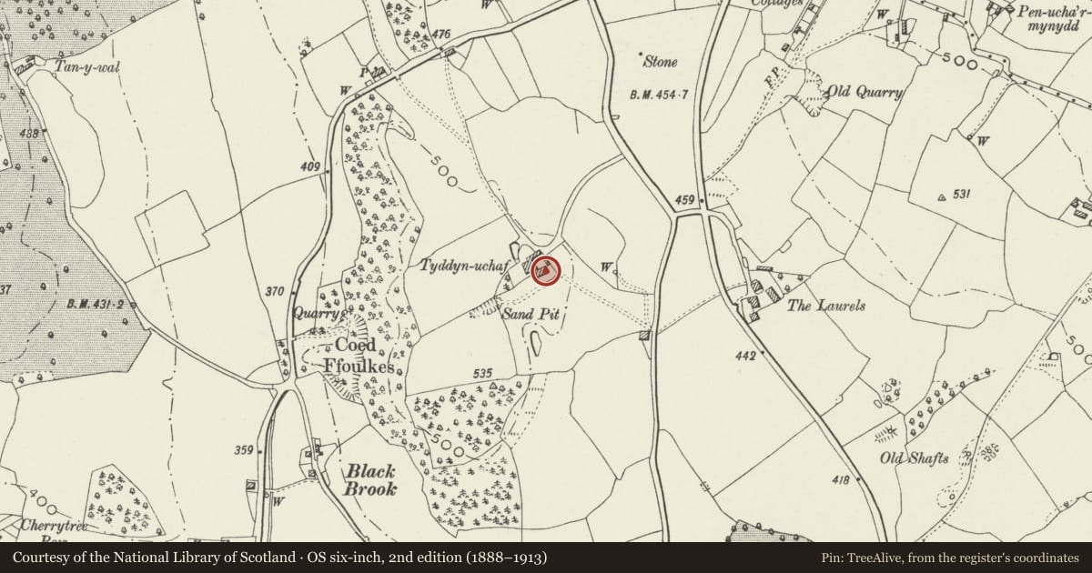
5 historical maps cover this location, the earliest the 1795 map "To Sir Watkin Williams-Wynn Bart ... the map of the six counties of North Wales is most humbly inscribed by his obedient humble servant" (Llyfrgell Genedlaethol Cymru – The National Library of Wales).
Historical maps covering this location
- 1795 · To Sir Watkin Williams-Wynn Bart ... the map of the six counties of North Wales is most… (Llyfrgell Genedlaethol Cymru – The National Library of Wales)
- 1883 · Watershed map England, Wales 3. (David Rumsey Map Collection, Stanford Libraries)
- 1898 · 108 Flint (Hills) (David Rumsey Map Collection, Stanford Libraries)
- 1898 · 108 Flint (Outline) (David Rumsey Map Collection, Stanford Libraries)
- 1901 · Sheet 9 and 10. (David Rumsey Map Collection, Stanford Libraries)
Cadw's description
Location
Prominently situated on a hill by Coed Ffoulkes at the end of a track from the lane to maes gruffydd from the Civic Centre.
Exterior
Late c16 in origin with evidence to suggest a timber frame. Comprehensive rebuilding in later c19 by Gwysaney estate and recent modernisation. Storey, l-shaped. Coursed sandstone rubble. Modern slate roof, deep eaves and verges. Large C16 projecting shouldered chimney on plinth to cross wing. Raised in c19 and later in brick. Modern brick stack to main range. C19 stone mullioned windows, returned labels, modern glazing. New windows to rear elevation. C19 front door.
Interior
Interior of cross wing retains c16 ceiling framed 3 ways. Stop chamfered beams and joists. Ceiling bisected by C19 wall. Cambered stop chamfered mantel beam. Traces of original close studding around window. Doorframe survives set in wall oposite C19 staircase.
Nearby in the register
- Bryn TudorDomesticunder 1 mi
- Stable at Bryn TudorDomesticunder 1 mi
- Theatr ClwydCivilunder 1 mi
- IslwynDomesticunder 1 mi
Other entries of the same register within about three miles of this one, by straight line.