Cof Cymru: National Historic Assets of Wales · Wales
Wayside Cottage
Ysceifiog, Flintshire, Wales
A Grade II listed building in Walwen, Holywell, Ysceifiog, Flintshire, designated on 31 January 2001.
The record
- Designation
- Listed building, Grade II
- Broad class
- Domestic
- Date of designation
- 31 January 2001
- Locality
- Walwen
- Town
- Holywell
- Community
- Ysceifiog
- Unitary authority
- Flintshire
- Country
- Wales
- Coordinates
- 53.23180, -3.24221
- Cadw reference
- 24667
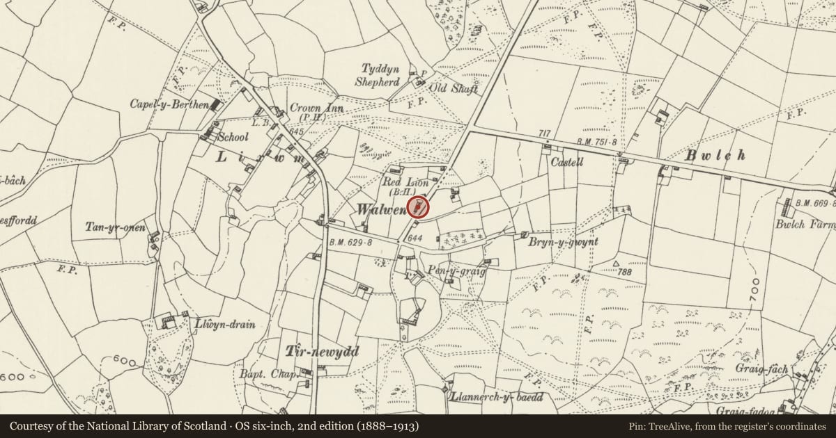
Slide toward Today to fade the historical sheet and see the modern map underneath.
David Rumsey Map Collection, Stanford LibrariesDavid Rumsey Map Collection, Stanford LibrariesDavid Rumsey Map Collection, Stanford LibrariesDavid Rumsey Map Collection, Stanford LibrariesLlyfrgell Genedlaethol Cymru – The National Library of Wales
5 historical maps cover this location, the earliest the 1795 map "To Sir Watkin Williams-Wynn Bart ... the map of the six counties of North Wales is most humbly inscribed by his obedient humble servant" (Llyfrgell Genedlaethol Cymru – The National Library of Wales).
Historical maps covering this location
- 1795 · To Sir Watkin Williams-Wynn Bart ... the map of the six counties of North Wales is most… (Llyfrgell Genedlaethol Cymru – The National Library of Wales)
- 1883 · Watershed map England, Wales 3. (David Rumsey Map Collection, Stanford Libraries)
- 1898 · 108 Flint (Hills) (David Rumsey Map Collection, Stanford Libraries)
- 1898 · 108 Flint (Outline) (David Rumsey Map Collection, Stanford Libraries)
- 1901 · Sheet 9 and 10. (David Rumsey Map Collection, Stanford Libraries)
Cadw's description
Location
On the E side of Lixwm village and set back from the road behind a rubble-stone wall.
History
Originally 2 cottages, built at different dates in the late C18, and an early example of single-storey cottage building that was to become characteristic of the region in the C19. Converted to a single cottage by the mid C20.
Exterior
Formerly 2 C18 2-unit single-storey cottages placed at a slight angle. Of rubble stone, partly rendered, painted white and slate roof. The R-hand cottage has rendered end stacks, the L-hand has a ridge stack L of centre. The windows have C19 wooden mullions and small cusped lights above transoms. The R-hand cottage has a central porch with single-light side windows similar to the main cottage and a boarded door with vertical ribs. The L-hand cottage has a 3-light window incorporating a casement. An added parallel gabled wing is built against the rear angle of the L-hand cottage. The rear of the house has windows replaced in earlier openings, with windows to the 2 rooms of the R-hand cottage and a small window in the doorway inserted between the cottages. The L-hand cottage has added rear projections.
Interior
Both cottages comprise 2 rooms and retain large fireplaces with timber lintels in their former kitchens. The R-hand cottage has a C19 cast iron fireplace in its side room.
Reason for designation
Listed as a well-preserved early example of the distinctive single-storey regional house type.
Nearby in the register
- Pantyrodyn CottageDomesticunder 1 mi
- Bakehouse at Llwyn TewDomesticunder 1 mi
- Llwyn TewDomesticunder 1 mi
- Monument to John Owen & William Llwyd at Capel y BerthenCommemorativeunder 1 mi
Other entries of the same register within about three miles of this one, by straight line.