Cof Cymru: National Historic Assets of Wales · Wales
Llwyn Tew
Ysceifiog, Flintshire, Wales
A Grade II listed building in Lixwm, Holywell, Ysceifiog, Flintshire, designated on 31 January 2001.
The record
- Designation
- Listed building, Grade II
- Broad class
- Domestic
- Date of designation
- 31 January 2001
- Locality
- Lixwm
- Town
- Holywell
- Community
- Ysceifiog
- Unitary authority
- Flintshire
- Country
- Wales
- Coordinates
- 53.23213, -3.24765
- Cadw reference
- 24682
Slide toward Today to fade the historical sheet and see the modern map underneath.
David Rumsey Map Collection, Stanford LibrariesDavid Rumsey Map Collection, Stanford LibrariesDavid Rumsey Map Collection, Stanford LibrariesDavid Rumsey Map Collection, Stanford LibrariesLlyfrgell Genedlaethol Cymru – The National Library of Wales
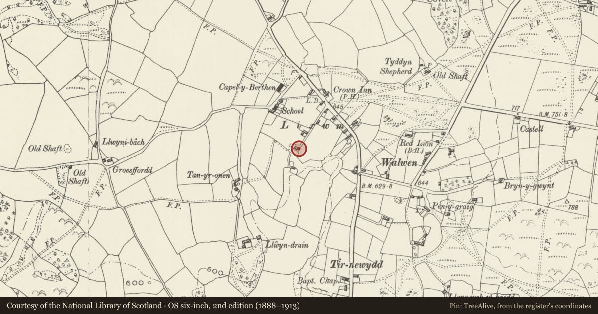
5 historical maps cover this location, the earliest the 1795 map "To Sir Watkin Williams-Wynn Bart ... the map of the six counties of North Wales is most humbly inscribed by his obedient humble servant" (Llyfrgell Genedlaethol Cymru – The National Library of Wales).
Historical maps covering this location
- 1795 · To Sir Watkin Williams-Wynn Bart ... the map of the six counties of North Wales is most… (Llyfrgell Genedlaethol Cymru – The National Library of Wales)
- 1883 · Watershed map England, Wales 3. (David Rumsey Map Collection, Stanford Libraries)
- 1898 · 108 Flint (Hills) (David Rumsey Map Collection, Stanford Libraries)
- 1898 · 108 Flint (Outline) (David Rumsey Map Collection, Stanford Libraries)
- 1901 · Sheet 9 and 10. (David Rumsey Map Collection, Stanford Libraries)
Cadw's description
Location
An isolated house on the W side of Lixwm village, reached by track and footpath on the W side of the B5121.
History
A small 2-unit C17 house with detached bakehouse. Rear and side wings were added to the house in the second half of the C19.
Exterior
A 2-storey house with parallel 2-storey rear wing and single-storey wing to the L side, of pebble dashed walls and the main house with a synthetic slate roof, the wings C19 slates. The original house has external stacks to both gable ends, pebble-dashed to the L and rubble stone to the R. The front has renewed openings, comprising a doorway to the L with replaced door, and sash window to the R, both openings late C19 under segmental heads, and a wider upper storey window below the eaves. The wing on the L side has a segmental-headed fixed window, L of which is a 2-window outshut with renewed and enlarged windows, and a metal-framed window in its gable end. The rear has 2 fixed windows. The rear wing has a small-pane window under segmental head in the lower storey and horizontal-sliding sash window beneath the eaves. In its gable end, opposite the bakehouse, is a segmental-headed window boarded up.
Interior
Not inspected.
Reason for designation
Listed as a rare example of a small C17 house retaining early character.
Nearby in the register
- Bakehouse at Llwyn TewDomesticunder 1 mi
- Pantyrodyn CottageDomesticunder 1 mi
- Monument to John Owen & William Llwyd at Capel y BerthenCommemorativeunder 1 mi
- Capel y BerthenReligious, Ritual and Funeraryunder 1 mi
Other entries of the same register within about three miles of this one, by straight line.